We use cookies for your personalized browsing experience, to personalize content and ads, to provide social media features, and to analyze traffic to our website. We also share information about your use of our website with our social media, advertising and analytics partners. Our partners may combine this information with other data that you have provided to them or that they have collected as part of your use of the Services. (incl. US providers)

Start Point

Leutasch, Ahrn (1.094m)

End Point

Ehrwald (994m)

Difficulty

Medium

Total Distance

23,00 km

Descent Meters

590 m

Highest Point

1590 m

Total Time

07:00 h

Map & Elevation Profile

Start Point

Leutasch, Ahrn (1.094m)

End Point

Ehrwald (994m)

Difficulty

Medium

Total Distance

23,00 km

Descent Meters

590 m

Highest Point

1590 m

Total Time

07:00 h

Hiking

Best Time

Jan

Feb

Mar

Apr

May

Jun

Jul

Aug

Sep

Oct

Nov

Dec

Eagle walk

Route: Leutasch/Ahrn - Ganghoferweg - Hämmermoosalm - Gaistalalm - Tillfußalm - Igelsee - Ehrwalder Alm - Ehrwald

Route description:

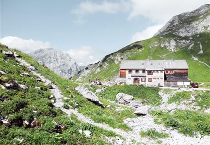
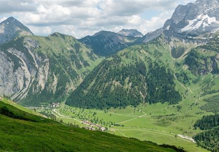
The hiker needs more stamina than strength for the trail from Leutasch/Ahrn via the Ehrwalder Alm to Ehrwald. You hike through the idyllic meadow landscape of Leutasch along the Leutascher Ache. On a wide driveway you enter the Gaistal, go left over the bridge and soon turn right onto the Ganghoferweg. Follow this comfortable path and, depending on your taste, take a break at the Hämmermoosalm, the Gaistalalm or the Tillfußalm. Just behind the Tillfußalm is the "Haus Hubertus" with a memorial plaque. The writer Ludwig Ganghofer (1855 - 1920) was a hunting leaseholder here at the beginning of the 20th century and host to the celebrities of his time between Richard Strauss, Hugo von Hofmannsthal and Franz von Defregger. Behind the Tillfußalm you orient yourself in a westerly direction going to the Igelsee, Gasthof Alpenglühn and Ehrwalder Alm. Below the alp begins the meadow path to Ehrwald.

Highlights:

  • Surrounded by the steep limestone walls of the Mieminger chain in the south and the Wetterstein mountains as well as the Zugspitze in the north, you

Read More...

Features & Characteristics

Start Point

Leutasch, Ahrn (1.094m)

End Point

Ehrwald (994m)

Similar Tour Suggestions

Solsteinhaus

Hiking

Eagle Walk Stage 14: Innsbruck - Hochzirl - Solsteinhaus

Length

7,00 km

Uphill

940 hm

Altitude

1800 hm

Difficulty

Medium

Pfeishuette

Hiking

Eagle Walk Stage 12: Hallerangerhaus - Pfeis hut - Hafelekar - Nordkette Innsbruck

Length

13,00 km

Duration

05:30 h

Uphill

1150 hm

Altitude

2280 hm

Difficulty

Hard

Wanderung-auf-die-Birkkarspitze

Hiking

Eagle Walk Stage 11: Karwendelhaus - Birkkarspitze - Hallerangerhaus

Length

14,00 km

Duration

08:30 h

Uphill

1440 hm

Altitude

2750 hm

Difficulty

Hard

Lamsenjochhütte

Hiking

Eagle Walk Stage 09: Lamsenjoch Hut - Falken Hut

Length

12,50 km

Duration

04:30 h

Uphill

810 hm

Downhill

920 hm

Altitude

1960 hm

Difficulty

Medium

Aufstieg Eppzirler Scharte - Karwendel Hoehenweg Etappe 2

Hiking

Eagle Walk Stage 15: Solsteinhaus - Scharnitz - Leutasch/Ahrn

Length

20,00 km

Duration

06:30 h

Uphill

870 hm

Downhill

1500 hm

Altitude

2110 hm

Difficulty

Medium

Lamsenjochhütte

Hiking

Eagle Walk Stage 08: Maurach - Lamsenjochhütte

Length

17,00 km

Duration

05:00 h

Uphill

1030 hm

Altitude

1950 hm

Difficulty

Medium

Karwendelhaus im Naturpark

Hiking

Eagle Walk Stage 10: Falken Hut - Karwendelhaus

Length

8,50 km

Duration

03:30 h

Uphill

550 hm

Altitude

1840 hm

Difficulty

Medium