We use cookies for your personalized browsing experience, to personalize content and ads, to provide social media features, and to analyze traffic to our website. We also share information about your use of our website with our social media, advertising and analytics partners. Our partners may combine this information with other data that you have provided to them or that they have collected as part of your use of the Services. (incl. US providers)
Start Point

Parkplatz Länd (P2)

End Point

Parkplatz Länd (P2)

Difficulty

Medium

Total Distance

17,80 km

Descent Meters

867 m

Ascent Meters

867 m

Highest Point

1744 m

Total Time

06:45 h

Map & Elevation Profile

Start Point

Parkplatz Länd (P2)

End Point

Parkplatz Länd (P2)

Difficulty

Medium

Total Distance

17,80 km

Descent Meters

867 m

Ascent Meters

867 m

Highest Point

1744 m

Total Time

06:45 h

Hiking

Best Time

Jan

Feb

Mar

Apr

May

Jun

Jul

Aug

Sep

Oct

Nov

Dec

Hiking tour

Circular hike

+1

Route: Scharnitz Nature Park Information Center - Café Länd - Bärenklamm - Mühlberg Forstweg - Mühlberg Lift Mountain Station - Mittagskopf - Zäunlkopf - Oberbrunnalm - Giessenbach - Scharnitz

Parking and public transport:

P2 "Karwendelparkplatz Länd".

By train to Scharnitz train station (10 minutes walk to the starting point).

You can find all connections in real time with the Mobility-App "wegfinder".

Directions:

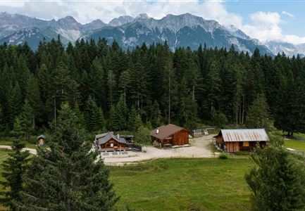
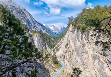
From the Scharnitz Nature Park Info Center, hike to the traditional Scharnitzer Alm along the so-called Nederweg trail to the entrance of the original Gleirschklamm gorge. But be careful: The narrow path through the gorge is only suitable for sure-footed hikers! The path impresses with impressive rock formations, small waterfalls and crystal clear water. After the gorge, the trail continues to the right, uphill to the Oberburnnalm - alternatively, a footpath leads off from the forest road through the Isertal. From the Oberbrunnalm a steep trail leads to the Zäunlkopf, also the about ten-minute detour to the "beautiful view" keeps what it promises. Then follow the path to the Mittagskopf and further to the former Mühlberglift mountain station. From there follow the signs to Scharnitz.  

Alpine emergency call:

Call: 140

Recommended Equipment

Trittsicherheit und gutes Schuhwerk.

Features & Characteristics

Start Point

Parkplatz Länd (P2)

End Point

Parkplatz Länd (P2)

Loop tour

Yes

Similar Tour Suggestions

Rosenkranzweg in Reith

Hiking

Circular hike panoramic path

Length

6,70 km

Duration

02:15 h

Uphill

289 hm

Altitude

1306 hm

Difficulty

Easy

Kaiser Maximilian Weg um den Wildsee - Seefeld

Hiking

Way of imperator Maximilian

Length

2,50 km

Duration

00:30 h

Uphill

3 hm

Altitude

1180 hm

Difficulty

Easy

Muggenmoosalm

Hiking

Circular hike from Seefeld to the Lottenseehütte alpine hut & Muggenmoosalm alpine hut

Length

15,30 km

Duration

04:30 h

Uphill

554 hm

Altitude

1398 hm

Difficulty

Easy

hochleithenkopf.jpg

Hiking

Hike to the Hochleithenkopf

Length

8,20 km

Duration

02:30 h

Uphill

200 hm

Altitude

1187 hm

Difficulty

Easy

Blick vom Karwendelsteg zum Karwendelbach mit Schnee auf den Bergen.jpg

Hiking

Circular hiking trail Karwendelschlucht/Karwendelsteg

Length

7,40 km

Duration

03:00 h

Uphill

266 hm

Altitude

1143 hm

Difficulty

Medium

Brunnsteinhütte

Hiking

Hike to the Brunnsteinhütte

Length

6,30 km

Duration

04:00 h

Uphill

588 hm

Altitude

1523 hm

Difficulty

Medium

Meilerhütte

Hiking

Hike to the Meilerhütte alpine hut

Length

13,00 km

Duration

09:00 h

Uphill

1352 hm

Downhill

36 hm

Altitude

2371 hm

Difficulty

Medium

Wegmarkierung

Hiking

Mountain tour crossing of the Arnspitzen

Length

11,50 km

Duration

08:30 h

Uphill

1353 hm

Altitude

2196 hm

Difficulty

Hard