We use cookies for your personalized browsing experience, to personalize content and ads, to provide social media features, and to analyze traffic to our website. We also share information about your use of our website with our social media, advertising and analytics partners. Our partners may combine this information with other data that you have provided to them or that they have collected as part of your use of the Services. (incl. US providers)
Start Point

Katzenkopf parking area (P14)

End Point

Katzenkopf parking area (P14)

Difficulty

Easy

Total Distance

5,20 km

Descent Meters

243 m

Highest Point

1360 m

Total Time

02:00 h

Map & Elevation Profile

Start Point

Katzenkopf parking area (P14)

End Point

Katzenkopf parking area (P14)

Difficulty

Easy

Total Distance

5,20 km

Descent Meters

243 m

Highest Point

1360 m

Total Time

02:00 h

Hiking

Best Time

Jan

Feb

Mar

Apr

May

Jun

Jul

Aug

Sep

Oct

Nov

Dec

Hiking tour

Hut hikes

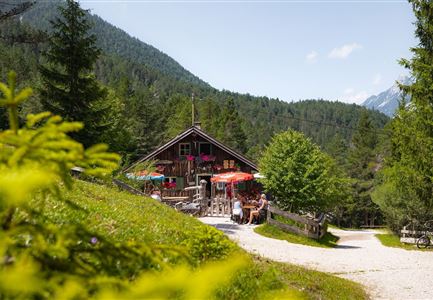
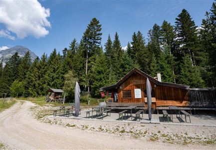
Route: Katzenkopf parking area (P14) - forest road - Katzenkopfhütte - forest road - Katzenkopf parking area (P14)

Parking and public transport:

P14 "Katzenkopf".

By train to Seefeld train station and continue with the Regio-/Skibus to the stop "Leutasch Kreithkapelle".

You can find all connections in real time with the Mobility-App "wegfinder".

Directions:

At the parking lot of the valley station follow the road to the right, after a few meters turn left into the forest. Then follow the forest road to the Katzenkopf hut, trail no. 34.

The ascent to the Katzenkopf hut is either via the forest road or by mountain railroad to the Katzenkopf.

Alpine emergency call:

Call: 140

Features & Characteristics

Start Point

Katzenkopf parking area (P14)

End Point

Katzenkopf parking area (P14)

Similar Tour Suggestions

Muggenmoos-Muggenmoosalm (c) Anna Rieder

Hiking

Hike to the Muggenmoosalm alpine hut

Length

3,60 km

Duration

01:15 h

Uphill

80 hm

Altitude

1252 hm

Difficulty

Easy

Friedensglocke Mösern zur Sonnenuntergangsstimmung im Frühling - Drohnenaufnahme Paar unterhalb der Glocke (1).jpg

Hiking

Peace Bell Hiking Trail

Length

4,90 km

Duration

01:30 h

Uphill

95 hm

Altitude

1289 hm

Difficulty

Easy

Wanderung auf die Birkkarspitze - Scharnitz (3) (2).jpg

Hiking

Hike from the Karwendelhaus to the Hinterautal

Length

9,20 km

Duration

07:00 h

Uphill

883 hm

Altitude

2642 hm

Difficulty

Hard

WM-Turm Sommer

Hiking

Circular walk Seefeld to the Jumping hill

Length

2,00 km

Duration

00:30 h

Uphill

15 hm

Altitude

1196 hm

Difficulty

Easy

Wanderung zur Scharnitzer Alm - Scharnitzer Alm mit Tannenzweigen im Vordergrund.jpg

Hiking

Circular hiking trail Scharnitzer alpine hut

Length

5,70 km

Duration

01:30 h

Uphill

130 hm

Altitude

1022 hm

Difficulty

Easy

Muggenmoosalm im Sommer mit Bauemen - Drohnenaufnahme (1).jpg

Hiking

Hike Schlagweg-Rauthgatter-Wildmoos

Length

11,50 km

Duration

03:30 h

Uphill

220 hm

Altitude

1345 hm

Difficulty

Easy

Ropferstubm im Herbst - Moesern-Buchen

Hiking

Hike to the Inn Ropferstub'm

Length

9,20 km

Duration

03:00 h

Uphill

246 hm

Altitude

1316 hm

Difficulty

Easy

Porta Claudia Scharnitz - Tor mit Weg.jpg

Hiking

Circular hiking trail Porta Claudia

Length

2,50 km

Duration

01:00 h

Uphill

125 hm

Downhill

120 hm

Altitude

1085 hm

Difficulty

Easy