We use cookies for your personalized browsing experience, to personalize content and ads, to provide social media features, and to analyze traffic to our website. We also share information about your use of our website with our social media, advertising and analytics partners. Our partners may combine this information with other data that you have provided to them or that they have collected as part of your use of the Services. (incl. US providers)

Start Point

Karwendelhaus

End Point

Kastenalm

Difficulty

Hard

Total Distance

9,20 km

Descent Meters

883 m

Highest Point

2642 m

Total Time

07:00 h

Map & Elevation Profile

Start Point

Karwendelhaus

End Point

Kastenalm

Difficulty

Hard

Total Distance

9,20 km

Descent Meters

883 m

Highest Point

2642 m

Total Time

07:00 h

Hiking

Best Time

Jan

Feb

Mar

Apr

May

Jun

Jul

Aug

Sep

Oct

Nov

Dec

Hiking tour

Route: Karwendelhaus - Schlauchkarsattel - Birkkarspitze - Hinterautal - Kastenalm

Directions:

Next to the Karwendelhaus begins the marked trail to the Birkkarspitze, which is initially quite steep and in places rope-secured in the rocky terrain through mountain pines and avalanche barriers up. Somewhat less steep, the route then heads in a southeasterly direction into the seemingly endless Schlauchkar. The route leads past the junction to the Hochalmkreuz (left) and the junction to the Brendelsteig (right). Here you keep the direction and climb somewhat laboriously - partly in rocky terrain and in unpleasant scree - up through the cirque. The cairns also provide orientation here. The path becomes increasingly steep, the last section to the Schlauchkar saddle runs in a southwesterly direction.

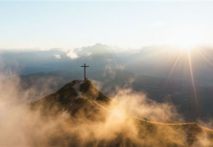
In this area, a hard snow field must be crossed most of the time, it is best to follow the footprints. From the Schlauchkar saddle (2,639 meters) then past the Birkkar hut (emergency shelter) and over the rope-secured climb in easy scrambling along the west ridge over to the summit of the Birkkarspitze (2,749 meters) with the cross. From the summit back to the Schlauchkar saddle and down to the south. First, the route descends steeply through boulders, in places

Read More...

Features & Characteristics

Refreshment stops

Start Point

Karwendelhaus

End Point

Kastenalm

Similar Tour Suggestions

Ederkanzel

Hiking

Circular hiking traill Franzosensteig - Ederkanzel

Length

7,40 km

Duration

04:00 h

Uphill

590 hm

Altitude

1569 hm

Difficulty

Medium

Reith - Wanderung Frau Häusl Kapelle - Bank und Bildstock mit Aussicht ins Inntal.jpg

Hiking

Circular hike panoramic path

Length

6,70 km

Duration

02:15 h

Uphill

289 hm

Altitude

1306 hm

Difficulty

Easy

Leutascher Geisterklamm mit Blick Richtung Mittenwald.jpg

Hiking

Long Gorge Trail through the Leutasch Spirit Gorge with Themed Trail

Length

3,20 km

Duration

01:30 h

Uphill

129 hm

Downhill

127 hm

Altitude

1060 hm

Difficulty

Medium

Closed
Schlossbachklamm mit Bahnstrecke - Reith.jpg

Hiking

Hike through the Schlossbachklamm Gorge

Length

12,20 km

Duration

04:30 h

Uphill

488 hm

Downhill

482 hm

Altitude

1129 hm

Difficulty

Easy

Closed
Falkenhütte neu

Hiking

Karwendelmarsch 52 km

Length

52,00 km

Duration

19:00 h

Uphill

2281 hm

Downhill

2217 hm

Altitude

1903 hm

Difficulty

Hard

Wildsee im Herbst - Drohnenaufnahme - Blick auf Golfplatz und See mit Bergpanorama.jpg

Hiking

Circular hike from Seefeld to Auland & Reith

Length

9,30 km

Duration

02:45 h

Uphill

139 hm

Downhill

141 hm

Altitude

1199 hm

Difficulty

Easy

Spaziergang an der Isar - Scharnitz (2).jpg

Hiking

Circular hiking trail to the Gleirschhöhe

Length

8,60 km

Duration

02:45 h

Uphill

212 hm

Altitude

1074 hm

Difficulty

Medium

Nördlinger Hütte - Wanderer kurz vor der Hütte (2).jpg

Hiking

Circular hike to the Nördlinger Hütte alpine hut & Reither Spitze Summit, 2,374m

Length

9,90 km

Duration

07:30 h

Uphill

1191 hm

Altitude

2374 hm

Difficulty

Hard