We use cookies for your personalized browsing experience, to personalize content and ads, to provide social media features, and to analyze traffic to our website. We also share information about your use of our website with our social media, advertising and analytics partners. Our partners may combine this information with other data that you have provided to them or that they have collected as part of your use of the Services. (incl. US providers)

Start Point

Ostbach Leutasch

End Point

Alpenbad Leutasch

Difficulty

Medium

Total Distance

2,70 km

Descent Meters

51 m

Highest Point

1183 m

Status

Open

Map & Elevation Profile

Start Point

Ostbach Leutasch

End Point

Alpenbad Leutasch

Difficulty

Medium

Total Distance

2,70 km

Descent Meters

51 m

Highest Point

1183 m

Status

Open

Cross-country Skiing

Best Time

Open

Jan

Feb

Mar

Apr

May

Jun

Jul

Aug

Sep

Oct

Nov

Dec

Ski-nordic-skating

Ski-nordic-classic

+2

Trail Entry:
Access via A6 Alpenbad. If you follow the A6 loop to the turnaround point in Ostbach, shortly after the houses, there is a small climb leading to the B11 trail.

Trail Character:
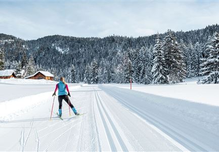
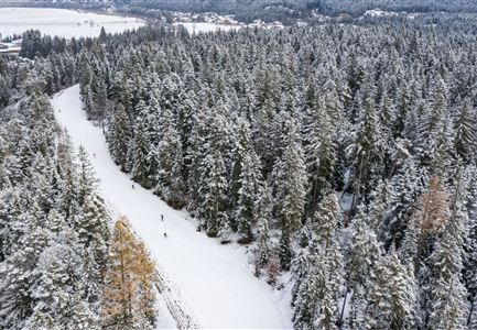
The B11 Forest Trail is a very idyllic route, starting through the woods and ascending from the Ostbach district (approx. 250 m after the Ostbach underpass). Crossing the hiking path twice, the trail descends back to the Alpenbad. This trail is better suited for experienced cross-country skiers.

Connecting Trails:
A6 Alpenbad 
An overview of the entire trail network (including trail status) and useful cross-country skiing information (ticket machines, waxing and service stations, changing facilities,...) can be found in the trail report

Features & Characteristics

Start Point

Ostbach Leutasch

End Point

Alpenbad Leutasch

Skating

Yes

Klassisch

Yes

Similar Tour Suggestions

A13 Scharnitz

Cross-country Skiing

A13 - Scharnitz-Klassik

Length

2,00 km

Uphill

32 hm

Altitude

998 hm

Difficulty

Easy

Open
Kaiser Maximilian Runde Seefeld

Cross-country Skiing

Adventure Run (classic & skating)

Length

55,00 km

Uphill

600 hm

Difficulty

Hard

Closed
Langlaeuferin auf der Loipe C2 im Wildmoos am Morgen - Klassisch

Cross-country Skiing

C2 - Wildmoos

Length

4,80 km

Uphill

144 hm

Altitude

1297 hm

Difficulty

Hard

Open
Drohnenbild Top Down einzelner Läufer in Lücke zwischen Bäumen.jpg

Cross-country Skiing

B14 – Waldloipe Alpenbad

Length

1,10 km

Uphill

10 hm

Altitude

1160 hm

Difficulty

Medium

Open
Langlaufen in der Region Seefeld - Langläuferin im Wildmoos.jpg

Cross-country Skiing

A3 - Torfstich

Length

1,80 km

Uphill

11 hm

Altitude

1317 hm

Difficulty

Easy

Open
Kaiser Maximilian Runde Leutasch

Cross-country Skiing

Kaiser Max Round (classic & skating)

Length

60,00 km

Uphill

659 hm

Altitude

1337 hm

Difficulty

Hard

Closed
C8 Rauthgatter Loipe - Buchen

Cross-country Skiing

C8 - Rauthgatter

Length

1,50 km

Uphill

77 hm

Altitude

1340 hm

Difficulty

Hard

Open
Klassische Langlauf Spur

Cross-country Skiing

B8 - Interalpen Connection West

Length

400 m

Uphill

24 hm

Altitude

1342 hm

Difficulty

Medium

Open