Tourismusverband Seefeld
We use cookies for your personalized browsing experience, to personalize content and ads, to provide social media features, and to analyze traffic to our website. We also share information about your use of our website with our social media, advertising and analytics partners. Our partners may combine this information with other data that you have provided to them or that they have collected as part of your use of the Services. (incl. US providers)

Start Point

Porta Claudia Scharnitz

End Point

Zirl Pfarrkirche

Difficulty

Easy

Total Distance

21,50 km

Descent Meters

317 m

Ascent Meters

637 m

Highest Point

1198 m

Total Time

06:30 h

Map & Elevation Profile

Start Point

Porta Claudia Scharnitz

End Point

Zirl Pfarrkirche

Difficulty

Easy

Total Distance

21,50 km

Descent Meters

317 m

Ascent Meters

637 m

Highest Point

1198 m

Total Time

06:30 h

Hiking

Best Time

Jan

Feb

Mar

Apr

May

Jun

Jul

Aug

Sep

Oct

Nov

Dec

Hiking

Long distance trails

+1

Route: Porta Claudia – Scharnitz – Seefeld // Seefeld – Auland – Reith – Leithen – Zirl – Innsbruck

It's well-known that all roads lead to Rome, especially among pilgrims. The Via Romea, a historic pilgrimage route from Stade near Hamburg through Tyrol to Rome, has now been officially certified.

The entire 2,200-kilometer pilgrimage route dates back to Albert of Stade, Abbot of the German monastery of the same name. He meticulously documented his pilgrimage to Rome and his audience with Pope Gregory IX in 1236. This allowed the pilgrimage route, named "Via Romea" by him, to be accurately reconstructed. Today, the German and Italian associations "Via Romea Germanica" share its maintenance.

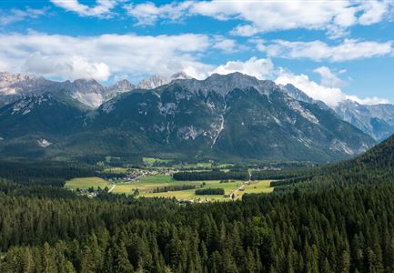
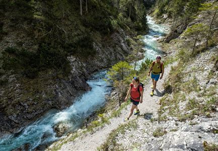
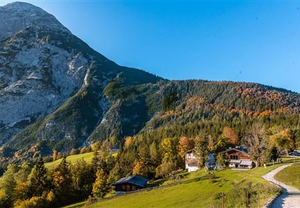
One of the most beautiful sections of the pilgrimage route spans 80 kilometers and four stages through Tyrol and the vast natural diversity of the Seefeld region - Tyrol's high plateau. Pilgrims first enter Tyrolean soil in Scharnitz, under the shadow of the historic Alpine fortress Porta Claudia. Here, they experience the impressive landscape along the Isar, walk past the Gießenbach, and pass through the Lehenwald forest. Following the ancient Romans, they continue along the expansive Karwendel Nature Park to Seefeld, the internationally known heart

Read More...

Features & Characteristics

Start Point

Porta Claudia Scharnitz

End Point

Zirl Pfarrkirche

Similar Tour Suggestions

Bienenlehrpfad Reith - Infotafel am Bienenhotel (1).jpg

Hiking

Hike Bee Nature Trail

Length

2,50 km

Duration

01:00 h

Uphill

72 hm

Altitude

1185 hm

Difficulty

Easy

Durchs Karwendeltal aufs Karwendelhaus - Scharnitz

Hiking

Hike to the Karwendelhaus

Length

36,00 km

Duration

11:15 h

Uphill

839 hm

Altitude

1765 hm

Difficulty

Hard

Familie in der Region Seefeld - Leutascher Ache.jpg

Hiking

Hike along the Achweg

Length

10,80 km

Duration

03:00 h

Uphill

70 hm

Downhill

78 hm

Altitude

10777 hm

Difficulty

Easy

Wanderung zur Eppzirler Alm im Sommer - Mann und Frau von hinten mit Eppzirler Alm.jpg

Hiking

Hike to the Eppzirler Alm alpine hut

Length

12,40 km

Duration

04:00 h

Uphill

475 hm

Altitude

1459 hm

Difficulty

Medium

Reith Wiesenweg im Frühling - Drohnenaufnahme strahlend grüne Wiese mit Blick zum Inntal.jpg

Hiking

Circular hiking traill Wiesenweg

Length

4,60 km

Duration

01:30 h

Uphill

109 hm

Altitude

1128 hm

Difficulty

Easy

Innsbruck Hafelekar - Karwendel Hoehenweg Etappe 3

Hiking

Karwendel High Trail

Length

70,00 km

Duration

27:30 h

Uphill

4470 hm

Downhill

4600 hm

Altitude

2699 hm

Difficulty

Hard

Aussichtsplattform Kurblhang - Leutasch.jpg

Hiking

Circular hiking trail viewpoint Kurblhang

Length

3,50 km

Duration

01:30 h

Uphill

181 hm

Altitude

1277 hm

Difficulty

Medium

Scharnitz - Wanderung Dorfrunde - Scharnitz im Überblick.jpg

Hiking

Hike from Seefeld to Scharnitz

Length

9,60 km

Duration

02:45 h

Uphill

35 hm

Downhill

301 hm

Altitude

1252 hm

Difficulty

Easy

Closed