We use cookies for your personalized browsing experience, to personalize content and ads, to provide social media features, and to analyze traffic to our website. We also share information about your use of our website with our social media, advertising and analytics partners. Our partners may combine this information with other data that you have provided to them or that they have collected as part of your use of the Services. (incl. US providers)

Start Point

Naturpark Info Center Scharnitz (P2)

End Point

Naturpark Info Center Scharnitz (P2)

Difficulty

Medium

Total Distance

15,90 km

Descent Meters

780 m

Ascent Meters

774 m

Highest Point

1753 m

Total Time

05:00 h

Map & Elevation Profile

Start Point

Naturpark Info Center Scharnitz (P2)

End Point

Naturpark Info Center Scharnitz (P2)

Difficulty

Medium

Total Distance

15,90 km

Descent Meters

780 m

Ascent Meters

774 m

Highest Point

1753 m

Total Time

05:00 h

Hiking

Best Time

Jan

Feb

Mar

Apr

May

Jun

Jul

Aug

Sep

Oct

Nov

Dec

Hiking tour

Hut hikes

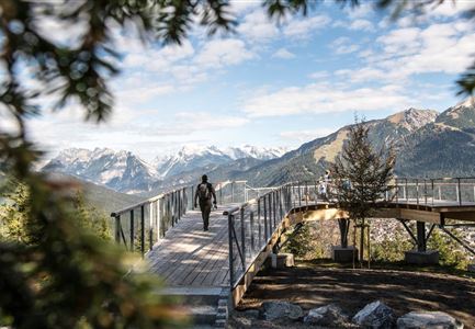
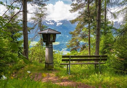
From the Nature Park Info Center Scharnitz, follow the Hinterautalstraße about 2 km into the valley, then take a turn to the left and hike in a few serpentines to the so-called Lablehner (open meadow, with a beautiful view of the Brunnstein and into the Karwendel Valley). The path becomes flatter for a short distance (always keep to the right) and continues in numerous serpentines, steadily uphill to the Pleisenhütte, which invites you to take a break with its wonderful south-facing sun terrace.

This tour can also be extended with the mountain hike to the Pleisenspitze, 2,569 m.
 

Features & Characteristics

Start Point

Naturpark Info Center Scharnitz (P2)

End Point

Naturpark Info Center Scharnitz (P2)

Similar Tour Suggestions

Blick auf Arnspitzen Ueberschreitung - Scharnitz

Hiking

Mountain tour crossing of the Arnspitzen

Length

11,50 km

Duration

08:30 h

Uphill

1353 hm

Altitude

2196 hm

Difficulty

Hard

Durch die Gleirschklamm bei Scharnitz.jpg

Hiking

Circular hiking trail Gleirschklamm Gorge

Length

13,10 km

Duration

04:00 h

Uphill

416 hm

Downhill

410 hm

Altitude

1152 hm

Difficulty

Medium

Closed
Durchs Karwendeltal aufs Karwendelhaus - Scharnitz

Hiking

Hike to the Karwendelhaus

Length

36,00 km

Duration

11:15 h

Uphill

839 hm

Altitude

1765 hm

Difficulty

Medium

Durch die Gleirschklamm - Scharnitz (1).jpg

Hiking

Circular hike through the Gleirsch Gorge and over the Zäunlkopf

Length

17,90 km

Duration

06:45 h

Uphill

907 hm

Altitude

1744 hm

Difficulty

Medium

Closed
Drohnenaufnahme Gschwandtkopf Speichersee - Person läuft entlang des Speichersees mit Hohe Munde im Hintergrund (3).jpg

Hiking

Hike on the Gschwandtkopf mountain

Length

11,60 km

Duration

03:30 h

Uphill

297 hm

Altitude

1485 hm

Difficulty

Medium

Personen bei der Rotmoosalm im Sommer - auf der Terrasse (1).jpg

Hiking

Hike to the Rotmoosalm alpine hut

Length

9,00 km

Duration

05:30 h

Uphill

842 hm

Altitude

2037 hm

Difficulty

Medium

Muggenmoos-Muggenmoosalm (c) Anna Rieder

Hiking

Hike to the Muggenmoosalm alpine hut

Length

3,60 km

Duration

01:15 h

Uphill

80 hm

Altitude

1252 hm

Difficulty

Easy

Hallerangeralm

Hiking

Bike & Hike Sunntigerspitze Summit, 2,321 m

Length

42,00 km

Duration

09:00 h

Uphill

1396 hm

Altitude

2321 hm

Difficulty

Medium