Start Point

ErlebnisWelt Alpenbad Leutasch

End Point

ErlebnisWelt Alpenbad Leutasch

Difficulty

Easy

Total Distance

3,70 km

Descent Meters

63 m

Ascent Meters

64 m

Highest Point

1156 m

Total Time

00:50 h

Map & Elevation Profile

Start Point

ErlebnisWelt Alpenbad Leutasch

End Point

ErlebnisWelt Alpenbad Leutasch

Difficulty

Easy

Total Distance

3,70 km

Descent Meters

63 m

Ascent Meters

64 m

Highest Point

1156 m

Total Time

00:50 h

Running

Best Time

Jan

Feb

Mar

Apr

May

Jun

Jul

Aug

Sep

Oct

Nov

Dec

Nordic walking

Running tracks

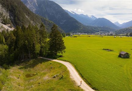
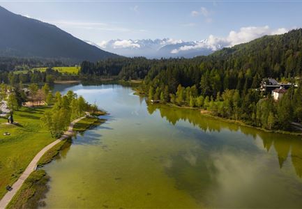
This easy run starts at Alpenbad Leutasch and takes you around Weidachsee.

From Alpenbad, the route initially follows the road toward the primary school, then continues straight ahead, following the signs to Weidachsee (at the intersection, continue toward Haus Gehrenspitze).

A well-paved gravel path leads you to the entrance of Weidachsee and the lakeside café, which features its own fishing operation.

The trail circles the lake along the promenade, offering beautiful views of the water and surrounding mountains at every turn while keeping a comfortable pace.

For a quick break, the lakeside café is perfect for recharging—whether with a freshly caught trout or a refreshing drink.

Once reenergized, you return the same way back to Alpenbad. And if you're not ready to call it a day, you can cap off your visit with a session at ErlebnisWelt Alpenbad Leutasch.

The indicated running time is a guideline and depends on personal fitness.

Similar Tour Suggestions

Scharnitz - Wanderung Dorfrunde - Weg von Gießenbach nach Scharnitz mit Läufer.jpg

Running

Village Running Loop Scharnitz

Length

8,30 km

Duration

02:00 h

Uphill

42 hm

Altitude

1010 hm

Difficulty

Easy

Trailrunning in der Region Seefeld - Läuferinnen in Seefeld - Fußgängerzone.jpg

Running

Village Running Loop Seefeld

Length

4,90 km

Duration

01:00 h

Uphill

22 hm

Altitude

1207 hm

Difficulty

Easy

Ganghofertrail 2024 - einzelzer Läufer im Wald bei Weidachsee.jpg

Running

Moos Running Route

Length

8,70 km

Duration

01:00 h

Uphill

104 hm

Downhill

100 hm

Altitude

1188 hm

Difficulty

Easy

Trailrunning in der Region Seefeld - Abkühlung an der Leutascher Ache - Gaistal.jpg

Running

Village Running Loop Leutasch

Length

6,20 km

Duration

01:45 h

Uphill

73 hm

Altitude

1195 hm

Difficulty

Easy

Wildsee im Frühling bei Morgenstimmung - Drohnenaufnahme Seepromenade.jpg

Running

Auland Running Route

Length

8,90 km

Duration

02:30 h

Uphill

128 hm

Altitude

1200 hm

Difficulty

Medium

Skisprungschanzen kurz vorm Sonnenuntergang (1).jpg

Running

Stadium Running Route

Length

3,00 km

Duration

00:45 h

Uphill

50 hm

Altitude

1202 hm

Difficulty

Easy

Reith Wiesenweg im Frühling - Weg entlang grüner Wiesen.jpg

Running

Village Running Loop Reith

Length

4,60 km

Duration

01:30 h

Uphill

105 hm

Altitude

1128 hm

Difficulty

Easy

Wanderung zur Scharnitzer Alm - Isar mit Blumen im Vordergrund - Hochformat.jpg

Running

Isar Running Route

Length

8,60 km

Duration

02:00 h

Uphill

30 hm

Altitude

970 hm

Difficulty

Easy