We use cookies for your personalized browsing experience, to personalize content and ads, to provide social media features, and to analyze traffic to our website. We also share information about your use of our website with our social media, advertising and analytics partners. Our partners may combine this information with other data that you have provided to them or that they have collected as part of your use of the Services. (incl. US providers)

Start Point

Information office Reith

End Point

Information office Reith

Difficulty

Hard

Total Distance

6,60 km

Descent Meters

254 m

Ascent Meters

252 m

Highest Point

1318 m

Map & Elevation Profile

Start Point

Information office Reith

End Point

Information office Reith

Difficulty

Hard

Total Distance

6,60 km

Descent Meters

254 m

Ascent Meters

252 m

Highest Point

1318 m

Cycling

Best Time

Jan

Feb

Mar

Apr

May

Jun

Jul

Aug

Sep

Oct

Nov

Dec

Mountainbike tour

Loop tour

Route: Information office Reith - Panoramaweg - Hölltal - Kaiserstand - Reith - Kaiserstandweg - Römerstraße - Information office Reith

Route description:

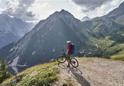
Turn left in front of the information office Reith and follow the main road until you reach the underpass. Shortly before the underpass, turn right into the forest road, which leads parallel to the railway tracks into the forest - follow this path until you reach the first turn-off. At this junction, turn right into Panoramaweg. Follow the gravel path through the valley Hölltal until you reach the turn-off to Kaiserstand. Arrived at the Kaiserstand at an altitude of almost 1400 metres, you can enjoy the view during a well-deserved break. For the return path, follow the same path downhill to the second turn-off - turn left at the second turn-off and follow the gravel path until you reach the village of Reith again. Follow the Kaiserstandweg to the turn-off into Römerstraße - at the turn-off turn right into Römerstraße and follow it until you reach the information office Reith again.

Alpine emergency call:

Call: 140

Features & Characteristics

Stamina

Technique

Start Point

Information office Reith

End Point

Information office Reith

Loop tour

Yes

Similar Tour Suggestions

E-Biken in Mösern mit Blick auf die Hohe Munde

Cycling

Bikeroute No. 5080 Rauthhütte

Length

5,00 km

Uphill

423 hm

Downhill

416 hm

Altitude

1601 hm

Difficulty

Hard

Radfahrer bei der Auffahrt zur Rotmoosalm - Pause mit Blick auf die Berge

Cycling

Biketour Nr. 553 Gaistal-Rotmoosalm

Length

20,10 km

Uphill

838 hm

Downhill

834 hm

Altitude

2032 hm

Difficulty

Hard

Gravelbiken in der Region Seefeld (12).jpg

Cycling

Gravelbiketour Hinterautal

Length

53,40 km

Uphill

590 hm

Downhill

578 hm

Altitude

1220 hm

Difficulty

Easy

Radfahrerinnen auf dem Weg zur Gaistalalm - 01.jpg

Cycling

Gravelbiketour Gaistal

Uphill

353 hm

Downhill

194 hm

Altitude

1363 hm

Difficulty

Medium

Gravelbiker auf der Gleirschhoehe im Hinterautal - Naturpark Karwendel

Cycling

Biketour No. 581 Gleirschtal-Pfeishütte

Length

39,00 km

Uphill

1152 hm

Downhill

1145 hm

Altitude

1922 hm

Difficulty

Hard

Ebiken

Cycling

Biketour No. 588 Reith-Eigenhofen

Length

5,70 km

Uphill

6 hm

Downhill

528 hm

Altitude

1123 hm

Difficulty

Hard

Closed
Wildmoos (c) Anna Rieder

Cycling

Biketour No. 5069 Seefeld-Wildmoos

Length

6,30 km

Uphill

122 hm

Downhill

120 hm

Altitude

1308 hm

Difficulty

Medium

Pfarrkirche im Sommer - Moesern

Cycling

Biketour No. 5068 Mösern-Brunschkopf

Length

8,90 km

Uphill

281 hm

Altitude

1496 hm

Difficulty

Medium