We use cookies for your personalized browsing experience, to personalize content and ads, to provide social media features, and to analyze traffic to our website. We also share information about your use of our website with our social media, advertising and analytics partners. Our partners may combine this information with other data that you have provided to them or that they have collected as part of your use of the Services. (incl. US providers)

Start Point

Weidach car park football field (P21)

End Point

Weidach car park football field (P21)

Difficulty

Easy

Total Distance

7,40 km

Descent Meters

128 m

Ascent Meters

128 m

Highest Point

1156 m

Total Time

02:00 h

Map & Elevation Profile

Start Point

Weidach car park football field (P21)

End Point

Weidach car park football field (P21)

Difficulty

Easy

Total Distance

7,40 km

Descent Meters

128 m

Ascent Meters

128 m

Highest Point

1156 m

Total Time

02:00 h

Hiking

Best Time

Jan

Feb

Mar

Apr

May

Jun

Jul

Aug

Sep

Oct

Nov

Dec

Hiking tour

Circular hike

+4

Route: Weidach car park football field (P21) - Höhenweg - Gasse - Lehner - via Runst - Weidach car park football field (P21)

Parking and public transport:

P21 "Weidach parking lot soccer field", P23 "Alpenbad parking lot".

By train to Seefeld train station and continue by bus to the stop "Alpenbad/Brücke".

You can find all connections in real time with the Mobility-App "wegfinder".

Directions:

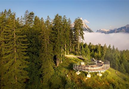
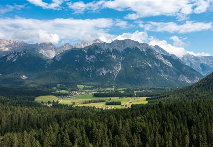
This trail leads at the foot of the Gehrenspitze along the edge of the meadow from Kirchplatzl to Gasse and there behind the bakery further to Lehner. The viewing platform Höhenweg offers an impressive panoramic view over the wide Leutasch valley. Return to the starting point via Runst. From here you can continue the trail to Unterleutasch.

Alpine emergency call:

Call: 140

Features & Characteristics

Start Point

Weidach car park football field (P21)

End Point

Weidach car park football field (P21)

Family-friendly

Yes

Stroller-friendly

Yes

Loop tour

Yes

Similar Tour Suggestions

Muggenmoosalm

Hiking

Circular hike from Seefeld to the Lottenseehütte alpine hut & Muggenmoosalm alpine hut

Length

15,30 km

Duration

04:30 h

Uphill

554 hm

Altitude

1398 hm

Difficulty

Easy

Durchs Karwendeltal aufs Karwendelhaus - Scharnitz

Hiking

Hike to the Karwendelhaus

Length

36,00 km

Duration

11:15 h

Uphill

839 hm

Altitude

1765 hm

Difficulty

Medium

Leutascher Geisterklamm mit Blick Richtung Mittenwald.jpg

Hiking

Long Gorge Trail through the Leutasch Spirit Gorge with Themed Trail

Length

3,20 km

Duration

01:30 h

Uphill

129 hm

Downhill

127 hm

Altitude

1060 hm

Difficulty

Medium

Reith - Wanderung Frau Häusl Kapelle - Bank und Bildstock mit Aussicht ins Inntal.jpg

Hiking

Circular hike panoramic path

Length

6,70 km

Duration

02:15 h

Uphill

289 hm

Altitude

1306 hm

Difficulty

Easy

Hofladenrunde Leutasch - Frau vor Wirtseppeler Hof.jpg

Hiking

Leutasch Farm Shop Circular Hike

Length

11,50 km

Duration

03:10 h

Uphill

111 hm

Downhill

108 hm

Altitude

1194 hm

Difficulty

Easy

Meilerhütte

Hiking

Hike to the Meilerhütte alpine hut

Length

13,00 km

Duration

09:00 h

Uphill

1352 hm

Downhill

36 hm

Altitude

2371 hm

Difficulty

Medium

Ausblick von der Arnplattenspitze auf die Gehrenspitze, Hohe Munde

Hiking

Circular hike Arnplattenspitze, 2,171 m

Length

8,60 km

Duration

07:00 h

Uphill

1106 hm

Altitude

2171 hm

Difficulty

Hard

Partially open
Wanderung auf die Birkkarspitze - Scharnitz (65).jpg

Hiking

Hike from the Karwendelhaus to the Hinterautal

Length

9,20 km

Duration

07:00 h

Uphill

883 hm

Altitude

2642 hm

Difficulty

Hard