Start Point

Bus Stop "Leutasch Burggraben GH Brücke"

End Point

Bus Stop "Leutasch Burggraben GH Brücke"

Difficulty

Easy

Total Distance

4,20 km

Descent Meters

13 m

Highest Point

1072 m

Total Time

00:45 h

Map & Elevation Profile

Start Point

Bus Stop "Leutasch Burggraben GH Brücke"

End Point

Bus Stop "Leutasch Burggraben GH Brücke"

Difficulty

Easy

Total Distance

4,20 km

Descent Meters

13 m

Highest Point

1072 m

Total Time

00:45 h

Hiking

Best Time

Jan

Feb

Mar

Apr

May

Jun

Jul

Aug

Sep

Oct

Nov

Dec

Hiking tour

Village walks

+3

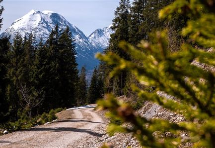
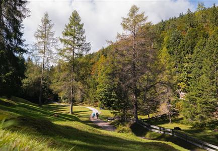
The hike begins behind the Gasthaus Brücke on a field path that winds through the district Moos. Passing Schweigl's Calf Pasture, an old sedge meadow that provides a habitat for many rare plants and animals, the path gently leads to the edge of the forest.

There, turn right towards Lochlehn. The trail runs peacefully between woods and meadows until reaching the Scheibe. At the next junction, continue right towards Unterkirchen.

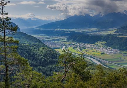
A beautiful cross-country path opens up views of the impressive Wetterstein Mountains and leads over the Leutascher Ache to the main road. Here, turn right and follow the road to the Church Johanneskirche, which houses, among other things, a rare statue of the "Scourged One".

Continue along the village road, passing old, traditionally painted farmhouses that reflect the charm of the Leutasch Valley. Finally, the loop ends back at the parking lot by the Gasthaus Brücke. A peaceful and varied tour that leads through beautiful meadow landscapes, offers great views, and a piece of village history.

Features & Characteristics

Start Point

Bus Stop "Leutasch Burggraben GH Brücke"

End Point

Bus Stop "Leutasch Burggraben GH Brücke"

Family-friendly

Yes

Loop tour

Yes

Similar Tour Suggestions

Wanderer auf der Gehrenspitze ueber Leutasch im Sonnenaufgang - Panoramaaufnahme.jpg

Hiking

Hike to the Gehrenspitze, 2,367 m

Length

22,80 km

Duration

10:00 h

Uphill

1319 hm

Altitude

2367 hm

Difficulty

Hard

Familie in der Region Seefeld - Spielen am Fluss - Leutascher Ache.jpg

Hiking

Hike to Unterleutasch Along the Achweg

Length

9,10 km

Duration

02:30 h

Uphill

3 hm

Downhill

77 hm

Altitude

1174 hm

Difficulty

Easy

Familie in der Region Seefeld - Leutascher Ache.jpg

Hiking

Hike along the Achweg

Length

10,80 km

Duration

03:00 h

Uphill

70 hm

Downhill

78 hm

Altitude

10777 hm

Difficulty

Easy

Wanderweg zur Hohen Fluder mit Blick Richtung Hohe Munde.jpg

Hiking

Hike Hoher Sattel

Length

10,60 km

Duration

04:00 h

Uphill

524 hm

Altitude

1620 hm

Difficulty

Medium

Wanderer auf der Seefelder Spitze ueber Seefeld

Hiking

Bike & Hike Seefelder Spitze Summit, 2,220 m

Length

13,00 km

Duration

04:30 h

Uphill

1094 hm

Altitude

2220 hm

Difficulty

Hard

Gleirschklamm - Scharnitz (17).jpg

Hiking

Hike through the Gleirschklamm to the Möslalm

Length

21,20 km

Duration

06:30 h

Uphill

505 hm

Downhill

498 hm

Altitude

1261 hm

Difficulty

Medium

Closed
Hölzernes Herz am Mühlberg in Scharnitz - Perspektive durch Gebüsch (1).jpg

Hiking

Hike to the Mühlberg Scharnitz

Length

6,50 km

Duration

02:30 h

Uphill

334 hm

Downhill

328 hm

Altitude

1315 hm

Difficulty

Medium

Wanderung zur Scharnitzer Alm - Scharnitzer Alm mit Tannenzweigen im Vordergrund.jpg

Hiking

Circular hiking trail Scharnitzer alpine hut

Length

5,70 km

Duration

01:30 h

Uphill

130 hm

Altitude

1022 hm

Difficulty

Easy