Start Point

Parking area Rauthhütte (P18)

End Point

Parking area Rauthhütte (P18)

Difficulty

Hard

Total Distance

11,30 km

Descent Meters

1410 m

Ascent Meters

1410 m

Highest Point

2562 m

Total Time

09:00 h

Map & Elevation Profile

Start Point

Parking area Rauthhütte (P18)

End Point

Parking area Rauthhütte (P18)

Difficulty

Hard

Total Distance

11,30 km

Descent Meters

1410 m

Ascent Meters

1410 m

Highest Point

2562 m

Total Time

09:00 h

Hiking

Best Time

Jan

Feb

Mar

Apr

May

Jun

Jul

Aug

Sep

Oct

Nov

Dec

Hiking tour

Hut hike

+1

This long and challenging hike requires excellent fitness, a head for heights, and surefootedness!

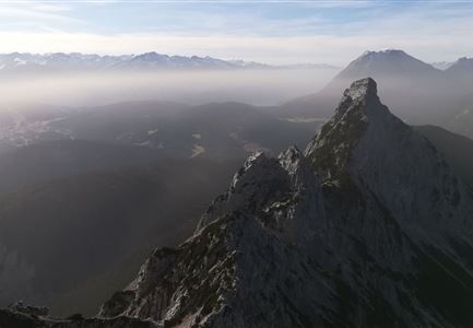
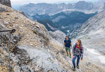
The hike starts at Parking Lot Munde (P18) in Leutasch-Moos. The trail initially goes right through the forest meadowland , until it joins the path from Obern to Rauthhütte. The ascent continues across up to Zugspitzblick, followed by a belt of larch trees, and then rocky and alpine terrain. The path steepens further, becoming more rocky as it leads to the East Peak (2,592 m). From there, the West Peak can be reached via the col.

For the descent, there are two options:

  • The same path back as the ascent.
  • A crossing of the West Peak and further descent to Niedere Munde (via fixed rope protection). From there, the choice is either to head down to Telfs via Strassberghaus or return to Leutasch through Gaistal.


For more information on the Hohe Munde Mountain Tour, check out this blog: The Hohe Munde - When the mountain calls

Features & Characteristics

Start Point

Parking area Rauthhütte (P18)

End Point

Parking area Rauthhütte (P18)

Similar Tour Suggestions

Ederkanzel

Hiking

Circular Hike via the Franzosensteig to Grünkopf and Ederkanzel

Length

7,40 km

Duration

04:00 h

Uphill

590 hm

Altitude

1569 hm

Difficulty

Medium

Nördlinger Hütte - Hütte mit Blick ins Inntal Richtung Süden (1).jpg

Hiking

Circular hike via Eppzirler Alm and Nördlinger hut to Seefeld

Length

20,40 km

Duration

10:00 h

Uphill

1464 hm

Altitude

2231 hm

Difficulty

Hard

Sonnenaufgang am Brunschkopf

Hiking

Circular hike to the Brunschkopf viewing platform starting in Mösern

Length

12,70 km

Duration

04:00 h

Uphill

382 hm

Altitude

1498 hm

Difficulty

Medium

Familie vor dem Seekirchl im Sommer - 2.jpg

Hiking

Circular walk Seefeld to the Jumping hill

Length

2,00 km

Duration

00:30 h

Uphill

10 hm

Altitude

1195 hm

Difficulty

Easy

Brunschkopf während der Goldenen Stunde.jpg

Hiking

Viewpoint Brunschkopf via forest road from Mösern

Length

9,10 km

Duration

03:00 h

Uphill

279 hm

Downhill

272 hm

Altitude

1496 hm

Difficulty

Medium

Leutascher Geisterklamm mit Blick Richtung Mittenwald.jpg

Hiking

Long Gorge Trail through the Leutasch Spirit Gorge with Themed Trail

Length

3,20 km

Duration

01:30 h

Uphill

129 hm

Downhill

127 hm

Altitude

1060 hm

Difficulty

Medium

Closed
Muggenmoosalm

Hiking

Circular hike from Seefeld to the Lottenseehütte alpine hut & Muggenmoosalm alpine hut

Length

15,30 km

Duration

04:30 h

Uphill

554 hm

Altitude

1398 hm

Difficulty

Medium

Bikepause an der Isarquelle.jpg

Hiking

Bike & Hike Halleranger house - Halleranger alm

Length

38,00 km

Duration

06:00 h

Uphill

832 hm

Altitude

1768 hm

Difficulty

Medium