Start Point

Seefeld Railway Station

End Point

Seefeld Railway Station

Difficulty

Medium

Total Distance

8,20 km

Descent Meters

200 m

Highest Point

1187 m

Total Time

02:30 h

Map & Elevation Profile

Start Point

Seefeld Railway Station

End Point

Seefeld Railway Station

Difficulty

Medium

Total Distance

8,20 km

Descent Meters

200 m

Highest Point

1187 m

Total Time

02:30 h

Hiking

Best Time

Jan

Feb

Mar

Apr

May

Jun

Jul

Aug

Sep

Oct

Nov

Dec

Hiking tour

Family-friendly

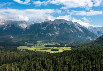
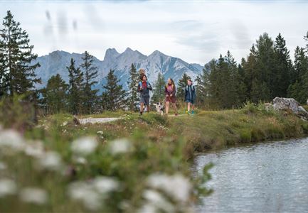
The hike starts at Seefeld train station and first leads through the pedestrian zone of the village. Passing cozy cafés and small shops, the route heads towards the Wildsee, where it joins the lake promenade. This scenic path winds through the forest, offering beautiful views of the water along the way.

At a junction, the trail turns right and descends across the Mähder, gentle meadows that lead down to Auland. From there, a gravel road continues towards Mühlberg, where the ascent to the Hochleithenkopf begins. This scenic viewpoint offers a wide-open view over the Inn Valley.

After a short break, the return follows the same route. The path leads back through Mühlberg and Auland, up across the Mähder, and through the forest along the lake promenade, returning to Seefeld train station.

Features & Characteristics

Stamina

Technique

Start Point

Seefeld Railway Station

End Point

Seefeld Railway Station

Family-friendly

Yes

Similar Tour Suggestions

Wettersteingebirge und Leutasch im Sommer - Drohnenaufnahme von der Muggenmoosalm.jpg

Hiking

Hike Schlagweg-Rauthgatter-Wildmoos

Length

11,50 km

Duration

03:30 h

Uphill

220 hm

Altitude

1345 hm

Difficulty

Easy

Leutascher Geisterklamm - Wasserfallsteig (2).jpg

Hiking

​Hike through the Leutasch Spirit Gorge and to the Waterfall Trail

Length

5,00 km

Duration

02:30 h

Uphill

225 hm

Downhill

221 hm

Altitude

1061 hm

Difficulty

Medium

Open
Pleisenhütte im Sommer - Scharnitz - quer.jpg

Hiking

Hike to the Pleisen alpine hut

Length

15,90 km

Duration

05:00 h

Uphill

780 hm

Downhill

774 hm

Altitude

1757 hm

Difficulty

Medium

Nördlinger Hütte - Wanderer kurz vor der Hütte (2).jpg

Hiking

Circular hike to the Nördlinger Hütte alpine hut & Reither Spitze Summit, 2,374m

Length

9,90 km

Duration

07:30 h

Uphill

1191 hm

Altitude

2374 hm

Difficulty

Hard

Durch die Gleirschklamm - Scharnitz (1).jpg

Hiking

Circular hike through the Gleirsch Gorge and over the Zäunlkopf

Length

17,90 km

Duration

06:45 h

Uphill

907 hm

Altitude

1744 hm

Difficulty

Medium

Closed
Ropferstubm im Herbst - Moesern-Buchen

Hiking

Hike to the Inn Ropferstub'm

Length

9,20 km

Duration

03:00 h

Uphill

246 hm

Altitude

1316 hm

Difficulty

Easy

Familie beim Wandern am Kaltwassersee - Seefeld (2).jpg

Hiking

Circular hiking traill to the Rosshütte alpine hut - Hochegg Alm alpine hut

Length

8,30 km

Duration

03:45 h

Uphill

515 hm

Altitude

1740 hm

Difficulty

Medium

Drohnenaufnahme Pleisenspitze im Sommer.jpg

Hiking

Hike to the Pleisenspitze Summit, 2,569 m

Length

20,10 km

Duration

10:30 h

Uphill

1600 hm

Altitude

2569 hm

Difficulty

Hard