We use cookies for your personalized browsing experience, to personalize content and ads, to provide social media features, and to analyze traffic to our website. We also share information about your use of our website with our social media, advertising and analytics partners. Our partners may combine this information with other data that you have provided to them or that they have collected as part of your use of the Services. (incl. US providers)

Start Point

Nature Park Information Center Scharnitz

End Point

Nature Park Information Center Scharnitz

Difficulty

Hard

Total Distance

20,10 km

Descent Meters

1600 m

Ascent Meters

1600 m

Highest Point

2569 m

Total Time

09:30 h

Map & Elevation Profile

Start Point

Nature Park Information Center Scharnitz

End Point

Nature Park Information Center Scharnitz

Difficulty

Hard

Total Distance

20,10 km

Descent Meters

1600 m

Ascent Meters

1600 m

Highest Point

2569 m

Total Time

09:30 h

Hiking

Best Time

Jan

Feb

Mar

Apr

May

Jun

Jul

Aug

Sep

Oct

Nov

Dec

Hiking tour

Summit tours

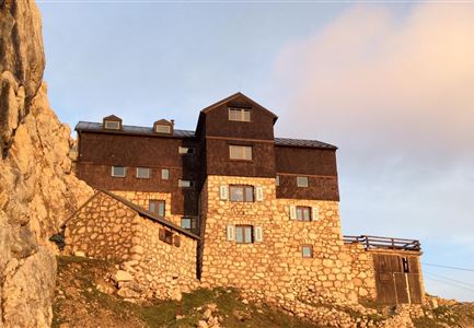
Route: Nature Park Info Center Scharnitz - Pleisenhütte - Pleisenspitze - Pleisenhütte - Nature Park Info Center Scharnitz

Parking and public transport:

P2 "Karwendelparkplatz Länd".

By train to Scharnitz train station (10 minutes walk to the starting point).

You can find all connections in real time with the Mobility-App "wegfinder".

Directions:

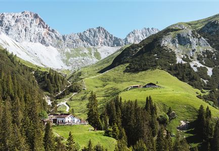
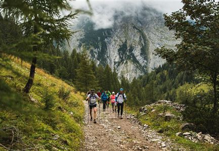
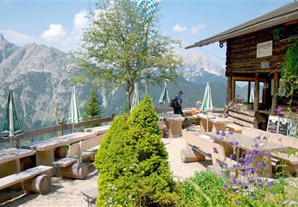
From the Nature Park Info Center Scharnitz, follow the Hinterautal road about 2 km into the valley, then take a turn to the left and hike in a few serpentines to the so-called Lablehner (open meadow, with a beautiful view of the Brunnstein and into the Karwendel valley). The path becomes flatter for a short distance (always keep to the right) and then continues in numerous serpentines, steadily uphill to the Pleisenhütte, which invites you to take a break with its wonderful south-facing sun terrace. Hikers in good shape continue the ascent to the Pleisenspitze. Directly behind the hut, a narrow, partly steep trail leads first through mountain pines and later across mountain meadows to the Pleisenspitze, which awaits the hiker with a magnificent view. The descent follows the ascent route. Surefootedness required!

For all those who are heading exclusively for the Pleisenhütte, there is also a

Read More...

Features & Characteristics

Start Point

Nature Park Information Center Scharnitz

End Point

Nature Park Information Center Scharnitz

Similar Tour Suggestions

Wanderung-auf-die-Birkkarspitze

Hiking

Bike & Hike Birkkarspitze Summit, 2,749 m

Length

41,00 km

Duration

09:00 h

Uphill

1800 hm

Altitude

2749 hm

Difficulty

Hard

Lottensee im Frühsommer - See und Hütte.jpg

Hiking

Circular hike to the Wildmossalm alpine hut & Lottenseehütte alpine hut

Length

7,10 km

Duration

02:30 h

Uphill

250 hm

Altitude

1420 hm

Difficulty

Easy

Weg zur Rauthhuette mit Blick auf das Wettersteingebirge

Hiking

Circular hiking to Rauthhütte alpine hut & Inntal Valley view

Length

6,20 km

Duration

03:00 h

Uphill

439 hm

Altitude

1599 hm

Difficulty

Medium

Blick ueber Wildmoos nach Seefeld.jpg

Hiking

Circular tour around the Brunschkopf

Length

12,80 km

Duration

04:00 h

Uphill

265 hm

Altitude

1371 hm

Difficulty

Easy

Kurze Pause an der Leutascher Ache - mit den Mountainbikes im Gaistal

Hiking

Bike & Hike Gehrenspitze Summit, 2,367 m

Length

21,00 km

Duration

07:00 h

Uphill

1179 hm

Altitude

2367 hm

Difficulty

Hard

Kinder bei Infotafel in der Geisterklamm.jpg

Hiking

Short Gorge Trail (with theme path)

Length

500 m

Uphill

10 hm

Difficulty

Easy

Gaistalalm im Herbst - Leutasch

Hiking

Hike to the Gaistalalm & Tillfussalm alpine hut

Length

9,70 km

Duration

03:00 h

Uphill

244 hm

Altitude

1404 hm

Difficulty

Easy

Panoramarestaurant Rosshütte

Hiking

Hiking to the Seefelder Spitze, 2,221 m and Seefelder Joch

Length

7,40 km

Duration

04:30 h

Uphill

1007 hm

Altitude

2221 hm

Difficulty

Medium

Open