Start Point

Naturpark Info Center Scharnitz (P2)

End Point

Railway Station Hochzirl

Difficulty

Hard

Total Distance

22,00 km

Descent Meters

940 m

Ascent Meters

975 m

Highest Point

1803 m

Total Time

08:00 h

Map & Elevation Profile

Start Point

Naturpark Info Center Scharnitz (P2)

End Point

Railway Station Hochzirl

Difficulty

Hard

Total Distance

22,00 km

Descent Meters

940 m

Ascent Meters

975 m

Highest Point

1803 m

Total Time

08:00 h

Hiking

Best Time

Jan

Feb

Mar

Apr

May

Jun

Jul

Aug

Sep

Oct

Nov

Dec

Hiking tour

Hut hike

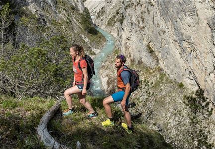
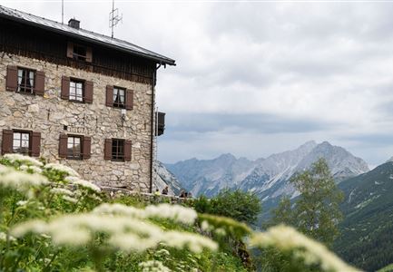
This challenging hike along the edge of the Karwendel range takes you through steep ascents, narrow trails, and the spectacular Gleirschklamm Gorge, with the Solsteinhaus as the perfect destination for a well-deserved break. Those with surefootedness and stamina will be rewarded with breathtaking views and unforgettable nature experiences.

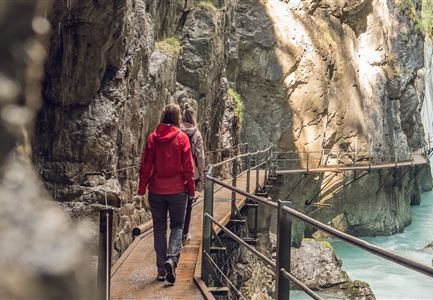
Starting from the Scharnitz Nature Park Information Center, the route leads to the rustic Scharnitzer Alm and continues along the so-called Nederweg to the entrance of the Gleirschklamm Gorge. Caution: the narrow trail through this wild and romantic gorge is suitable only for surefooted hikers! In return, you'll be treated to impressive rock formations, small waterfalls, and crystal-clear waters. After exiting the gorge, the path transitions to a forest road, which you follow left, descending briefly before climbing again to reach the Gleirschtal forest road.

Following this road further into the valley, you'll arrive at the Kristenalm junction. Turn right here and continue to the Kristenalm. If time and energy allow, it's a great spot for a short break before proceeding along the forest road to a stream crossing.

After crossing the stream, continue for 20 meters, then follow the signpost on the

Read More...

Features & Characteristics

Similar Tour Suggestions

Grosse Arnspitze Blick ins Karwendel - Scharnitz

Hiking

Hike Hoher Sattel - Große Arnspitze Summit, 2,196 m

Length

10,30 km

Duration

08:00 h

Uphill

1313 hm

Altitude

2196 hm

Difficulty

Hard

Sonnenaufgang im Karwendel_Speckkarspitze

Hiking

Bike & Hike Speckkarspitze, 2,621 m

Length

44,00 km

Duration

11:00 h

Uphill

1794 hm

Altitude

2621 hm

Difficulty

Hard

Blumenwiese in Neuleutasch

Hiking

Hike from Leutasch to Seefeld

Length

4,60 km

Duration

01:30 h

Uphill

118 hm

Downhill

83 hm

Altitude

1225 hm

Difficulty

Easy

Falkenhütte neu

Hiking

Karwendelmarsch 52 km

Length

52,00 km

Duration

19:00 h

Uphill

2281 hm

Downhill

2217 hm

Altitude

1903 hm

Difficulty

Hard

Hölzernes Herz am Mühlberg in Scharnitz - Perspektive durch Gebüsch (1).jpg

Hiking

Hike to the Mühlberg Scharnitz

Length

6,50 km

Duration

02:30 h

Uphill

334 hm

Downhill

328 hm

Altitude

1315 hm

Difficulty

Medium

Reith - Wanderung Frau Häusl Kapelle - Frau Häusl Kapelle mit Farn im Vordergrund.jpg

Hiking

On the rosary walking trail to the Frau Häusl chapel

Length

1,20 km

Duration

01:15 h

Uphill

100 hm

Altitude

1220 hm

Difficulty

Easy

Familien-Weitwanderung im Gaistal - Vater und Sohn auf schmalem Weg durch grüne Wiese (1).jpg

Hiking

Stage 2: To Rotmoosalm – Leutasch 3-Day Hut Hike for Families

Length

5,00 km

Uphill

400 hm

Downhill

130 hm

Altitude

2132 hm

Difficulty

Medium

Kristenalm

Hiking

Bike & Hike Kristenalm

Length

25,00 km

Duration

04:00 h

Uphill

420 hm

Altitude

1249 hm

Difficulty

Medium