We use cookies for your personalized browsing experience, to personalize content and ads, to provide social media features, and to analyze traffic to our website. We also share information about your use of our website with our social media, advertising and analytics partners. Our partners may combine this information with other data that you have provided to them or that they have collected as part of your use of the Services. (incl. US providers)

Start Point

Scharnitz information centre (parking Länd P2)

End Point

Scharnitz information centre (parking Länd P2)

Difficulty

Medium

Total Distance

7,40 km

Descent Meters

266 m

Highest Point

1143 m

Total Time

03:00 h

Map & Elevation Profile

Start Point

Scharnitz information centre (parking Länd P2)

End Point

Scharnitz information centre (parking Länd P2)

Difficulty

Medium

Total Distance

7,40 km

Descent Meters

266 m

Highest Point

1143 m

Total Time

03:00 h

Hiking

Best Time

Jan

Feb

Mar

Apr

May

Jun

Jul

Aug

Sep

Oct

Nov

Dec

Hiking tour

Circular hike

+2

Route: Nature Park Info Center Scharnitz - Hinterautalstraße - direction Karwendeltal - direction Karwendelhaus - Karwendelsteg - Isarbrücke - direction Scharnitz - Nature Park Info Center Scharnitz

Parking and public transport:

P2 "Karwendelparkplatz Länd".

By train to Scharnitz train station (10 minutes walk to the starting point).

Find all connections in real time with the Mobility-App "wegfinder".

Directions:

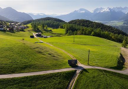
Panoramic hike approx. 3 h. From the Scharnitz Nature Park Info Center follow the Hinterautal road for approx. 1 km to the gravel works. At the gravel works, turn left onto a small path towards the Karwendel valley, which leads upwards in many serpentines to the forest road and offers wonderful views of the Karwendel gorge. Continue on this road to the right in the direction of the Karwendelhaus. If you want, after a good stretch you can make a small detour to the left to the Birzel chapel. Otherwise, continue on the forest road until you reach the turnoff to the Karwendelsteg on the right. You continue to follow this path until you reach the forest road towards Scharnitz to the right. The last two km via the road back to Scharnitz or shortly after the gravel

Read More...

Features & Characteristics

Start Point

Scharnitz information centre (parking Länd P2)

End Point

Scharnitz information centre (parking Länd P2)

Family-friendly

Yes

Loop tour

Yes

Similar Tour Suggestions

Kneippanlage beim Wildsee - Seefeld (2).jpg

Hiking

Kneipp facility & reflection walk in Seefeld

Length

7,60 km

Duration

02:00 h

Uphill

36 hm

Downhill

32 hm

Altitude

1250 hm

Difficulty

Easy

Wanderweg Hochleithenkopf - Ausblick ins Inntal.jpg

Hiking

Hike to the Hochleithenkopf

Length

8,20 km

Duration

02:30 h

Uphill

200 hm

Altitude

1187 hm

Difficulty

Easy

Wildmoosalm im Sommer - Alm aus der Distanz mit Gewässer im Vordergrund.jpg

Hiking

Circular hiking trail Wildmoos-Hochmoos

Length

10,00 km

Duration

04:00 h

Uphill

437 hm

Altitude

1544 hm

Difficulty

Medium

Seekirchl im Sommer - Seefeld

Hiking

Circular walk in the Möserer valley

Length

3,10 km

Duration

00:45 h

Uphill

12 hm

Altitude

1196 hm

Difficulty

Easy

Blumenwiese in Neuleutasch

Hiking

Hike from Leutasch to Seefeld

Length

4,60 km

Duration

01:30 h

Uphill

118 hm

Downhill

83 hm

Altitude

1225 hm

Difficulty

Easy

Durchs Karwendeltal aufs Karwendelhaus - Scharnitz

Hiking

Hike to the Karwendelhaus

Length

36,00 km

Duration

11:15 h

Uphill

839 hm

Altitude

1765 hm

Difficulty

Medium

kinder_bei_infotafel_in_der_geisterklamm.jpg

Hiking

Short Gorge Trail

Length

500 m

Duration

00:15 h

Uphill

10 hm

Altitude

1027 hm

Difficulty

Easy

Möserer See im Frühling - Paar läuft entlang des Seeweges.jpg

Hiking

Circular walking path from Seefeld to the lake Möserer See

Length

8,80 km

Duration

02:30 h

Uphill

231 hm

Altitude

1297 hm

Difficulty

Easy