Start Point

Seefeld Seekirchl

End Point

Seefeld Seekirchl

Difficulty

Easy

Total Distance

5,80 km

Descent Meters

131 m

Highest Point

1305 m

Total Time

01:45 h

Map & Elevation Profile

Start Point

Seefeld Seekirchl

End Point

Seefeld Seekirchl

Difficulty

Easy

Total Distance

5,80 km

Descent Meters

131 m

Highest Point

1305 m

Total Time

01:45 h

Hiking

Best Time

Jan

Feb

Mar

Apr

May

Jun

Jul

Aug

Sep

Oct

Nov

Dec

Hiking tour

Hut hike

+1

The tour starts directly at the Seekirchl in Seefeld. From here, the path leads through the Kirchwaldsiedlung towards Brunschkopf (trail No. 2), with a gentle incline. Shortly after, you reach the Hörmannweg, a peaceful trail winding through the forest.

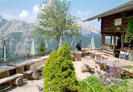
At a fork in the path, keep right towards Wildmoosalm. The trail continues to climb gently, offering beautiful views of Seefeld along the way. After a relaxed hike, you arrive at Wildmoosalm, a great spot to take a break and enjoy the surroundings.

The return follows the same route back to Seefeld.

Alternative Route to Wildmoosalm
If you prefer a wider forest road, start left across from the riding stables in Seefeld. This route also leads directly to Wildmoosalm and offers a comfortable alternative.

Note: This forest road is closed to private cars. It is only accessible for pedestrians and cyclists.

Features & Characteristics

Stamina

Technique

Start Point

Seefeld Seekirchl

End Point

Seefeld Seekirchl

Family-friendly

Yes

Similar Tour Suggestions

Falkenhütte neu

Hiking

Karwendelmarsch 52 km

Length

52,00 km

Duration

19:00 h

Uphill

2281 hm

Downhill

2217 hm

Altitude

1903 hm

Difficulty

Hard

Ausblick von der Arnplattenspitze auf die Gehrenspitze, Hohe Munde

Hiking

Circular hike Arnplattenspitze, 2,171 m

Length

8,60 km

Duration

07:00 h

Uphill

1106 hm

Altitude

2171 hm

Difficulty

Hard

Muggenmoosalm

Hiking

Circular hike from Seefeld to the Lottenseehütte alpine hut & Muggenmoosalm alpine hut

Length

15,30 km

Duration

04:30 h

Uphill

554 hm

Altitude

1398 hm

Difficulty

Medium

Blick ueber Wildmoos nach Seefeld.jpg

Hiking

Circular tour around the Brunschkopf

Length

13,10 km

Duration

04:00 h

Uphill

275 hm

Downhill

272 hm

Altitude

1369 hm

Difficulty

Easy

Fischerrei am Weidachsee - Leutasch

Hiking

Circular walk around Weidachsee lake

Length

3,80 km

Duration

01:00 h

Uphill

46 hm

Altitude

1156 hm

Difficulty

Easy

Rauthhütte in Leutasch

Hiking

Circular hiking to Rauthhütte alpine hut & Inntal Valley view

Length

6,20 km

Duration

03:00 h

Uphill

439 hm

Altitude

1599 hm

Difficulty

Medium

Wanderer auf dem Weg vom Seefelder Joch zur Seefelder Spitze - Gipfelkreuz der Spitze im Blick.jpg

Hiking

"Königstour" The royal's hiking tour

Length

4,40 km

Duration

03:00 h

Uphill

502 hm

Downhill

464 hm

Altitude

2364 hm

Difficulty

Hard

Drohnenaufnahme Gschwandtkopf Speichersee - Person läuft entlang des Speichersees mit Hohe Munde im Hintergrund (3).jpg

Hiking

Hike on the Gschwandtkopf mountain

Length

11,60 km

Duration

03:30 h

Uphill

297 hm

Altitude

1485 hm

Difficulty

Medium