We use cookies for your personalized browsing experience, to personalize content and ads, to provide social media features, and to analyze traffic to our website. We also share information about your use of our website with our social media, advertising and analytics partners. Our partners may combine this information with other data that you have provided to them or that they have collected as part of your use of the Services. (incl. US providers)

Start Point

ErlebnisWelt Alpenbad Leutasch

End Point

ErlebnisWelt Alpenbad Leutasch

Difficulty

Easy

Total Distance

42,00 km

Descent Meters

1056 m

Ascent Meters

1049 m

Highest Point

1359 m

Map & Elevation Profile

Start Point

ErlebnisWelt Alpenbad Leutasch

End Point

ErlebnisWelt Alpenbad Leutasch

Difficulty

Easy

Total Distance

42,00 km

Descent Meters

1056 m

Ascent Meters

1049 m

Highest Point

1359 m

Running

Best Time

Jan

Feb

Mar

Apr

May

Jun

Jul

Aug

Sep

Oct

Nov

Dec

Hiking

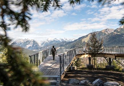
This 42km Olympia Walk covers just about every village of the Region Seefeld. The start is at 06.00 in the direction of Neuleutasch, Triendlsäge and the Bodenalm, before a lengthy stretch towards Reith bei Seefeld. Returning, the tour goes over the Möserer Steig past the periodic lakes, the Lottensee and Wildmoossee, before returning to the departure point.

Features & Characteristics

Start Point

ErlebnisWelt Alpenbad Leutasch

End Point

ErlebnisWelt Alpenbad Leutasch

Similar Tour Suggestions

Noerdlinger Huette - Karwendel Hoehenweg Etappe 1 & 2

Hiking

Karwendel High Trail (Trail 2): Nördlinger Hütte - Solsteinhaus

Length

6,70 km

Duration

04:00 h

Uphill

370 hm

Downhill

795 hm

Altitude

2239 hm

Difficulty

Hard

Hämmermoosalm mit Gebirgskette

Hiking

Eagle Walk Stage 16: Leutasch/Ahrn - Ehrwald

Length

23,00 km

Duration

07:00 h

Uphill

590 hm

Altitude

1590 hm

Difficulty

Medium

Brunnsteinspitze mit Gipfelkreuz - Scharnitz (4).jpg

Hiking

Hike to the Brunnsteinspitze Summit, 2,180 m

Length

12,70 km

Duration

08:30 h

Uphill

1454 hm

Altitude

2180 hm

Difficulty

Hard

Grosse Arnspitze Blick ins Karwendel - Scharnitz

Hiking

Hike Hoher Sattel - Große Arnspitze Summit, 2,196 m

Length

10,30 km

Duration

08:00 h

Uphill

1313 hm

Altitude

2196 hm

Difficulty

Hard

Aufstieg Stempeljoch - Karwendel Hoehenweg Etappe 4

Hiking

Karwendel High Trail (Trail 4): Pfeishütte - Bettelwurfhütte

Length

8,90 km

Duration

04:30 h

Uphill

590 hm

Downhill

390 hm

Altitude

2215 hm

Difficulty

Hard

Solsteinhaus

Hiking

Eagle Walk Stage 14: Innsbruck - Hochzirl - Solsteinhaus

Length

7,00 km

Uphill

940 hm

Altitude

1800 hm

Difficulty

Medium

Katzenkopfhuette mit Blumenwiese im Sommer

Hiking

Hike to the Katzenkopfhütte alpine hut

Length

5,20 km

Duration

02:00 h

Uphill

243 hm

Altitude

1360 hm

Difficulty

Easy

Kurze Pause an der Leutascher Ache - mit den Mountainbikes im Gaistal

Hiking

Bike & Hike Gehrenspitze Summit, 2,367 m

Length

21,00 km

Duration

07:00 h

Uphill

1179 hm

Altitude

2367 hm

Difficulty

Hard