Start Point

ErlebnisWelt Alpenbad Leutasch

End Point

ErlebnisWelt Alpenbad Leutasch

Difficulty

Easy

Total Distance

9,90 km

Descent Meters

290 m

Ascent Meters

61 m

Highest Point

1370 m

Total Time

03:15 h

Map & Elevation Profile

Start Point

ErlebnisWelt Alpenbad Leutasch

End Point

ErlebnisWelt Alpenbad Leutasch

Difficulty

Easy

Total Distance

9,90 km

Descent Meters

290 m

Ascent Meters

61 m

Highest Point

1370 m

Total Time

03:15 h

Running

Best Time

Jan

Feb

Mar

Apr

May

Jun

Jul

Aug

Sep

Oct

Nov

Dec

Attraction

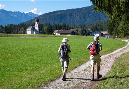
Day 2 of the 3-day Unicorn March begins with a 10 km hike to the Katzenkopf. The tour starts at the ErlebnisWelt Alpenbad Leutasch and follows the Achweg trail to Unterweidach and then on to Weidach. After crossing the Fludertal, the hike continues to the Katzenkopf, where a supply station awaits at the Katzenkopfhütte. From there, a lift takes you down to the valley station, and the tour finally ends back at the ErlebnisWelt Alpenbad Leutasch.

Features & Characteristics

Start Point

ErlebnisWelt Alpenbad Leutasch

End Point

ErlebnisWelt Alpenbad Leutasch

Similar Tour Suggestions

Paar vor dem Seekirchl im Sommer - Seefeld in Tirol.jpg

Hiking

Circular walk in the Möserer valley

Length

3,10 km

Duration

00:45 h

Uphill

12 hm

Altitude

1196 hm

Difficulty

Easy

Familie vor dem Seekirchl im Sommer - 2.jpg

Hiking

Circular walk Seefeld to the Jumping hill

Length

2,00 km

Duration

00:30 h

Uphill

10 hm

Altitude

1195 hm

Difficulty

Easy

Teilnehmer vom Einhornmarsch auf einem Forstweg auf dem Weg nach Kirchplatzl mit Blick Richtung Kirche.jpg

Running

IML Unicorn March Day 3: 42 km - Gaistal Valley Hike

Length

42,00 km

Duration

10:00 h

Uphill

1102 hm

Downhill

1068 hm

Altitude

1417 hm

Difficulty

Easy

Hölzernes Herz am Mühlberg in Scharnitz - Perspektive durch Gebüsch (1).jpg

Hiking

Hike to the Mühlberg Scharnitz

Length

6,50 km

Duration

02:30 h

Uphill

334 hm

Downhill

328 hm

Altitude

1315 hm

Difficulty

Medium

Sonnenaufgang Aussichtsplattform Bruschkopf - Paar steht am Geländer der Plattform - Aufnahme von hinten - Paar schaut sich an.jpg

Hiking

Viewpoint Brunschkopf via Möserer Höhe

Length

8,70 km

Duration

03:00 h

Uphill

311 hm

Downhill

314 hm

Altitude

1499 hm

Difficulty

Medium

Herbst am Möserer See - Frau am Ufer (Edit 2).jpg

Hiking

Circular walking path lake Möserer See & Kalvarienberg

Length

3,00 km

Duration

01:00 h

Uphill

78 hm

Downhill

82 hm

Altitude

1291 hm

Difficulty

Easy

Teilnehmer_innen des Einhornmarsches von hinten auf einer Brücke in Reindlau, Leutasch (1).jpg

Running

IML Unicorn March Day 1: 10km - Runst-Hike

Length

10,20 km

Duration

02:45 h

Uphill

80 hm

Altitude

1148 hm

Difficulty

Easy

(c)Olympiaregion-Seefeld-Sebastian-Marko-Ganghoferlauf-Leutasch-(76).jpg

Cross-country Skiing

Race Euroloppet Ganghoferlauf - classic 25 km

Length

25,00 km

Uphill

253 hm

Altitude

1226 hm

Difficulty

Hard