We use cookies for your personalized browsing experience, to personalize content and ads, to provide social media features, and to analyze traffic to our website. We also share information about your use of our website with our social media, advertising and analytics partners. Our partners may combine this information with other data that you have provided to them or that they have collected as part of your use of the Services. (incl. US providers)

Start Point

Scharnitz information centre (parking Länd P2)

End Point

Engalm

Difficulty

Hard

Total Distance

35,00 km

Descent Meters

1664 m

Ascent Meters

1358 m

Highest Point

1843 m

Total Time

12:30 h

Map & Elevation Profile

Start Point

Scharnitz information centre (parking Länd P2)

End Point

Engalm

Difficulty

Hard

Total Distance

35,00 km

Descent Meters

1664 m

Ascent Meters

1358 m

Highest Point

1843 m

Total Time

12:30 h

Hiking

Best Time

Jan

Feb

Mar

Apr

May

Jun

Jul

Aug

Sep

Oct

Nov

Dec

Hiking tour

Long distance trails

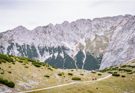
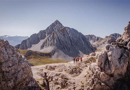
The "little Karwendel march" starts in Scharnitz and ends in the Eng. Hikers with good physical condition can complete the entire route in one day. For those who want to take it more leisurely, there are overnight accommodations at the Karwendelhaus or the Falkenhütte.

Please note that there is not a daily bus connection from the Eng back to the starting point!

The small Karwendel march leads over the following route points:

the Schafstallboden (1.173 m),

the Karwendelhaus (1.771 m),

the small Ahornboden (1.399 m),

the Falkenhütte (1.848 m),

the Engalm is the DESTINATION (1.227 m) - 35 km

The indicated march duration is a guideline and depends on personal fitness.

Karwendelmarsch - The legend lives! Find more information about the sporting highlight here.

Alpine emergency call:

Call: 140

Features & Characteristics

Start Point

Scharnitz information centre (parking Länd P2)

End Point

Engalm

Similar Tour Suggestions

Schlossbachklamm mit Bahnstrecke - Reith.jpg

Hiking

Hike through the Schlossbachklamm

Length

12,20 km

Duration

04:30 h

Uphill

488 hm

Downhill

482 hm

Altitude

1129 hm

Difficulty

Easy

Personen bei der Rotmoosalm im Sommer - auf der Terrasse (1).jpg

Hiking

Hike to the Rotmoosalm alpine hut

Length

9,00 km

Duration

05:30 h

Uphill

842 hm

Altitude

2037 hm

Difficulty

Medium

Hallerangeralm

Hiking

Bike & Hike Sunntigerspitze Summit, 2,321 m

Length

42,00 km

Duration

09:00 h

Uphill

1396 hm

Altitude

2321 hm

Difficulty

Medium

Seefelder Spitze im Sonnenuntergang

Hiking

Hiking to the Seefelder Spitze, 2,221 m and Seefelder Joch

Length

7,40 km

Duration

04:30 h

Uphill

1010 hm

Downhill

167 hm

Altitude

2221 hm

Difficulty

Medium

Open
Eppzirler Scharte - Karwendel Hoehenweg Etappe 2

Hiking

Karwendel High Trail (Trail 2): Nördlinger Hütte - Solsteinhaus

Length

6,70 km

Duration

04:00 h

Uphill

370 hm

Downhill

795 hm

Altitude

2239 hm

Difficulty

Hard

Leutasch Sommer 2022 Wandern Hoehenweg Panoramaplattform

Hiking

Circular walk Höhenweg - Runst

Length

7,40 km

Duration

02:00 h

Uphill

128 hm

Altitude

1156 hm

Difficulty

Easy

Lärchenwald in Reith - Drohnenaufnahme - Paar läuft zur den Wald - Aufnahme Richtung Sonne.jpg

Hiking

Round the Gschwandtkopf Hill (Circular Walk)

Length

10,60 km

Duration

03:30 h

Uphill

226 hm

Downhill

220 hm

Altitude

1344 hm

Difficulty

Easy

Lafatscher Hochleger Richtung Hallerangerhaus - Karwendel Hoehenweg Etappe 5

Hiking

Karwendel High Trail (Trail 5): Bettelwurfhütte - Hallerangerhaus

Length

9,00 km

Duration

06:00 h

Uphill

800 hm

Downhill

1100 hm

Altitude

2183 hm

Difficulty

Hard