We use cookies for your personalized browsing experience, to personalize content and ads, to provide social media features, and to analyze traffic to our website. We also share information about your use of our website with our social media, advertising and analytics partners. Our partners may combine this information with other data that you have provided to them or that they have collected as part of your use of the Services. (incl. US providers)

Start Point

Katzenkopf parking area (P14)

End Point

Katzenkopf parking area (P14)

Difficulty

Medium

Total Distance

10,00 km

Descent Meters

437 m

Ascent Meters

437 m

Highest Point

1544 m

Total Time

04:00 h

Map & Elevation Profile

Start Point

Katzenkopf parking area (P14)

End Point

Katzenkopf parking area (P14)

Difficulty

Medium

Total Distance

10,00 km

Descent Meters

437 m

Ascent Meters

437 m

Highest Point

1544 m

Total Time

04:00 h

Hiking

Best Time

Jan

Feb

Mar

Apr

May

Jun

Jul

Aug

Sep

Oct

Nov

Dec

Hiking tour

Circular hike

+2

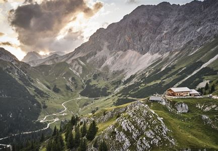
Route: Leutasch Katzenkopf - Fludertal - Wildmoosalm - Ferienkolonie Wildmoos - Hochmoos - Schlagwald - Leutasch Katzenkopf.

Parking and public transport:

P14 "Katzenkopf".

Take the train to Seefeld station and continue with the Regiobus to the stop "Leutasch Kreithkapelle".

You can find all connections in real time with the Mobility-App "wegfinder".

Directions:

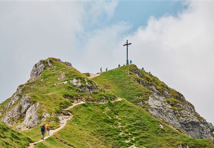
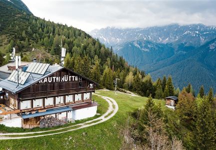
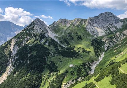
At the valley station of the Katzenkopf Leutasch go left past the Kreithalm. Follow trail no. 3 towards Wildmoosalm through the Fludertal valley until you reach Wildmoos. Pass the alpine pasture until you reach the Ferienkolonie Wildmoos, infront of them turn right to Hochmoos, trail no. 37. Wonderful viewpoint. On the remaining, the descent takes place in a northerly direction to the hut Katzenkopfhütte. From there you get back to the starting point via the forest road.

Alpine emergency call:

Call: 140

Features & Characteristics

Start Point

Katzenkopf parking area (P14)

End Point

Katzenkopf parking area (P14)

Family-friendly

Yes

Loop tour

Yes

Similar Tour Suggestions

Wanderung über der Karwendelschlucht - Scharnitz.jpg

Hiking

Circular hiking trail Karwendelschlucht/Karwendelsteg

Length

7,40 km

Duration

03:00 h

Uphill

266 hm

Altitude

1143 hm

Difficulty

Medium

Personen bei der Rotmoosalm im Sommer - auf der Terrasse (1).jpg

Hiking

Hike to the Rotmoosalm alpine hut

Length

9,00 km

Duration

05:30 h

Uphill

842 hm

Altitude

2037 hm

Difficulty

Medium

Spaziergang an der Isar - Scharnitz (2).jpg

Hiking

Circular hiking trail to the Gleirschhöhe

Length

8,60 km

Duration

02:45 h

Uphill

212 hm

Altitude

1074 hm

Difficulty

Medium

Kristenalm

Hiking

Bike & Hike Kristenalm

Length

25,00 km

Duration

04:00 h

Uphill

420 hm

Altitude

1249 hm

Difficulty

Medium

Seefelder Spitze im Sonnenuntergang

Hiking

Hiking to the Seefelder Spitze, 2,221 m and Seefelder Joch

Length

7,40 km

Duration

04:30 h

Uphill

1010 hm

Downhill

167 hm

Altitude

2221 hm

Difficulty

Medium

Open
Ederkanzel

Hiking

Circular hiking traill Franzosensteig - Ederkanzel

Length

7,40 km

Duration

04:00 h

Uphill

590 hm

Altitude

1569 hm

Difficulty

Medium

Wanderer auf der Seefelder Spitze ueber Seefeld

Hiking

Bike & Hike Seefelder Spitze Summit, 2,220 m

Length

13,00 km

Duration

04:30 h

Uphill

1094 hm

Downhill

799 hm

Altitude

2220 hm

Difficulty

Hard

Spaziergang mit Hund in Unterleutasch - Hund spricht ins Wasser an der Leutascher Ache.jpg

Hiking

Hike along the Achweg

Length

10,80 km

Duration

03:00 h

Uphill

70 hm

Downhill

78 hm

Altitude

10777 hm

Difficulty

Easy