We use cookies for your personalized browsing experience, to personalize content and ads, to provide social media features, and to analyze traffic to our website. We also share information about your use of our website with our social media, advertising and analytics partners. Our partners may combine this information with other data that you have provided to them or that they have collected as part of your use of the Services. (incl. US providers)
Start Point

Seefeld Seekirchl church

End Point

Seefeld Seekirchl church

Difficulty

Medium

Total Distance

9,60 km

Descent Meters

188 m

Ascent Meters

188 m

Highest Point

1370 m

Map & Elevation Profile

Start Point

Seefeld Seekirchl church

End Point

Seefeld Seekirchl church

Difficulty

Medium

Total Distance

9,60 km

Descent Meters

188 m

Ascent Meters

188 m

Highest Point

1370 m

Running

Best Time

Jan

Feb

Mar

Apr

May

Jun

Jul

Aug

Sep

Oct

Nov

Dec

Running tracks

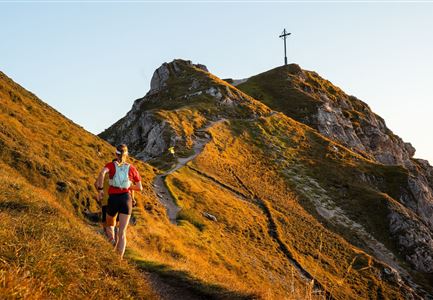
Profile: demanding and very hilly running route

Terrain: forest trail, meadow path

Route: Seekirchl - Kirchwald - Möserer Mähder - Möserer See / Möserer Seestub'n - Lehen Wald - Seekirchl

Directions:

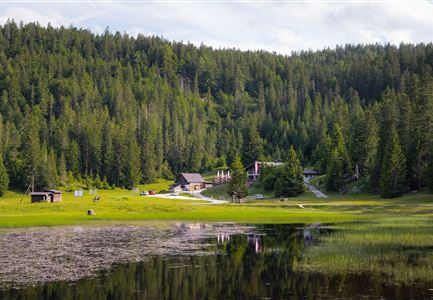
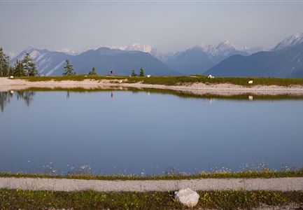
The route leads you uphill to the lake Möser. There at an intersection you have the choice of going to a panorama viewpoint Wildmoos or back to Seefeld. Leading through woods and across meadows, this roundabout trail provides lots of diversity for every taste.

Refreshment stop:

Möserer Seestub'n

The indicated running time is a guideline and depends on personal fitness.

Features & Characteristics

Start Point

Seefeld Seekirchl church

End Point

Seefeld Seekirchl church

Similar Tour Suggestions

Symbolbild

Running

Adlerweg track

Length

5,10 km

Uphill

76 hm

Downhill

73 hm

Altitude

1139 hm

Difficulty

Easy

Seekirchl im Sommer - Seefeld

Running

Gschwandtkopf Trail

Length

10,30 km

Uphill

343 hm

Downhill

332 hm

Altitude

1334 hm

Difficulty

Hard

Bodenalm mit Terasse und Gästen

Running

Magic Castle Run

Length

21,00 km

Uphill

507 hm

Downhill

504 hm

Altitude

1254 hm

Difficulty

Hard

Kirche in Scharnitz

Running

Isarrun

Length

7,80 km

Uphill

78 hm

Downhill

48 hm

Altitude

979 hm

Difficulty

Easy

Lottensee Panorama - Seefeld

Running

3-lakes run

Length

9,40 km

Uphill

251 hm

Downhill

271 hm

Altitude

1370 hm

Difficulty

Medium

Leutascher Ache im Sommer mit Blick auf die Hohe Munde - Weidach - 1350x1080 (1).jpg

Running

Leutascher Achenlauf track

Length

9,80 km

Uphill

84 hm

Downhill

116 hm

Altitude

1130 hm

Difficulty

Easy

Blick auf Seefeld vom Gschwandtkopf - Seefeld

Running

Gschwandtkopf Run

Length

5,50 km

Uphill

355 hm

Downhill

52 hm

Altitude

1475 hm

Difficulty

Medium

Blick auf den Weg zur Rotmoosalm im Abendlicht im Sommer

Running

Mountain Run Rotmoos

Length

25,60 km

Uphill

990 hm

Altitude

2032 hm

Difficulty

Hard