Tourismusverband Seefeld
We use cookies for your personalized browsing experience, to personalize content and ads, to provide social media features, and to analyze traffic to our website. We also share information about your use of our website with our social media, advertising and analytics partners. Our partners may combine this information with other data that you have provided to them or that they have collected as part of your use of the Services. (incl. US providers)

Trailrunning

Seefelder Spitze Trailrun Route

Start Point

Seefeld Valley Station Bergbahnen Rosshütte

End Point

Seefeld Valley Station Bergbahnen Rosshütte
Difficulty

Hard

Total Distance

11,70 km

Descent Meters

1000 m

Ascent Meters

1000 m

Highest Point

2214 m

Total Time

06:30 h

Map & Elevation Profile

Start Point

Seefeld Valley Station Bergbahnen Rosshütte

End Point

Seefeld Valley Station Bergbahnen Rosshütte

Difficulty

Hard

Total Distance

11,70 km

Descent Meters

1000 m

Ascent Meters

1000 m

Highest Point

2214 m

Total Time

06:30 h

Running

Best Time

Jan

Feb

Mar

Apr

May

Jun

Jul

Aug

Sep

Oct

Nov

Dec

Trailrunning

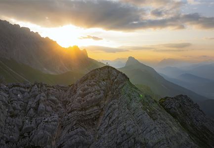
The route first follows a forest road parallel to the T-bar lift of the Rosshütte mountain lifts. At the base station of the chairlift, a trail begins along the Haglbach stream, which climbs steeply after about one kilometer. After crossing an alpine meadow, the Panoramarestaurant Rosshütte is reached.

From here, the real climb begins: a narrow trail leads up to the top station of the Jochlift. The route then continues along the trail to the Seefelder Spitze and below the Karwendel mountains towards the Reither Spitze. At the first junction leading back to Rosshütte, the trail turns right and heads directly back to the Rosshütte restaurant.

For the descent, there is the option to take the cable car down to the valley or run back via the ascent trail.

The indicated running time is an estimate and depends on individual fitness.

Features & Characteristics

Start Point

Seefeld Valley Station Bergbahnen Rosshütte

End Point

Seefeld Valley Station Bergbahnen Rosshütte
Similar Tour Suggestions

Karwendelmarsch Trainingscamp (5) (2).jpg

Running

Karwendel Run 52 km (Karwendelmarsch)

Length

52,00 km

Duration

06:00 h

Uphill

2158 hm

Downhill

2192 hm

Altitude

1900 hm

Difficulty

Hard

Gschwandtkopf Speichersee - Trailrunner in der Distanz läuft entlang des Sees bei Sonnenaufgangsstimmung.jpg

Running

Gschwandtkopf Trailrun Route

Length

9,80 km

Duration

03:30 h

Uphill

430 hm

Altitude

1486 hm

Difficulty

Easy

Trailrunning in der Region Seefeld - Läuferin auf dem Südwandsteig bergab.jpg

Running

Gaistal-Rotmoosalm Trail Run Loop

Length

15,00 km

Duration

06:30 h

Uphill

970 hm

Altitude

2133 hm

Difficulty

Medium

Trailrunning in der Region Seefeld - Läuferinnen auf Trail bergauf - Leutasch.jpg

Running

Gaistal Trailrun loop to Hämmermoosalm, Wettersteinhütte, and Wangalm

Length

10,30 km

Duration

04:00 h

Uphill

520 hm

Altitude

1721 hm

Difficulty

Easy

Lärchenwald bei Reith_Wald mit Sonnenstern.jpg

Running

Around the Gschwandtkopf Trailrun Route

Length

10,30 km

Duration

02:00 h

Uphill

343 hm

Downhill

332 hm

Altitude

1334 hm

Difficulty

Easy

Steg zum Wandern entlang der Gleirschklamm.jpg

Running

Trail Run Loop Isarsteig & Gleierschklamm

Length

12,40 km

Duration

04:00 h

Uphill

445 hm

Altitude

1250 hm

Difficulty

Easy

Trailrunning in der Region Seefeld - Gruppe auf Trail im Wald.jpg

Running

Trail Run Loop Alter Möserer Weg

Length

8,00 km

Duration

03:00 h

Uphill

470 hm

Altitude

1230 hm

Difficulty

Easy

Trailrunning auf der Seefelder Spitze - Läufer rennt im Sonnenuntergang.jpg

Running

Leutasch Trail (Salomon Zugspitz Ultratrail)

Length

68,00 km

Duration

16:00 h

Uphill

2870 hm

Downhill

3370 hm

Altitude

2049 hm

Difficulty

Hard