We use cookies for your personalized browsing experience, to personalize content and ads, to provide social media features, and to analyze traffic to our website. We also share information about your use of our website with our social media, advertising and analytics partners. Our partners may combine this information with other data that you have provided to them or that they have collected as part of your use of the Services. (incl. US providers)

Start Point

Music Pavilion Weidach (P15)

End Point

Music Pavilion Weidach (P15)

Difficulty

Easy

Total Distance

3,80 km

Descent Meters

46 m

Highest Point

1156 m

Total Time

01:00 h

Status

Open

Map & Elevation Profile

Start Point

Music Pavilion Weidach (P15)

End Point

Music Pavilion Weidach (P15)

Difficulty

Easy

Total Distance

3,80 km

Descent Meters

46 m

Highest Point

1156 m

Total Time

01:00 h

Status

Open

Hiking

Best Time

Open

Jan

Feb

Mar

Apr

May

Jun

Jul

Aug

Sep

Oct

Nov

Dec

Winter walking

Family-friendly

+2

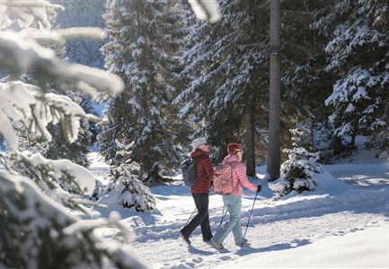
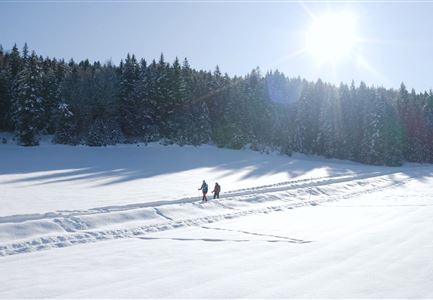
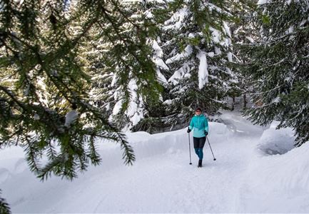
This exciting and beautiful winter hike leads from the music pavilion Leutasch around the snow-covered Weidachsee and back again. At the beginning of the music pavilion in the hamlet of Weidach, keep left along the road until you reach the Katznerkapelle. At the bus stop "Weidach Quellenhof" turn left to the Weidachsee. There you pass the lake café with its fishing business (in winter you can go ice fishing here) and follow the lake promenade around the Weidachsee.

If you get hungry on the way back, you can enjoy a freshly caught trout in the café or enjoy the idyllic lake view with a steaming hot drink. Afterwards, you can return to the starting point of the winter hike at the music pavilion, well fortified and warmed up. After your hike you can enjoy a break at the ErlebnisWelt Alpenbad Leutasch.

Features & Characteristics

Start Point

Music Pavilion Weidach (P15)

End Point

Music Pavilion Weidach (P15)

Family-friendly

Yes

Stroller-friendly

Yes

Loop tour

Yes

Similar Tour Suggestions

Winterwandern im Schnee (2) (2).jpg

Hiking

Stage 4: From Weidach through Fludertal and over Wildmoos to Seefeld - Seefeld High Plateau Winter Multi-day Hike

Length

7,85 km

Duration

02:30 h

Uphill

230 hm

Downhill

177 hm

Altitude

1339 hm

Difficulty

Easy

Open
Winterwandern Paar Friedensglocke Drohnen Nahaufnahme Paar steht am Geländer Blick ins Inntal (1).jpg

Hiking

W30: Winter hiking "Path of Peace"

Length

4,60 km

Duration

01:30 h

Uphill

92 hm

Downhill

96 hm

Altitude

1292 hm

Difficulty

Easy

Open
Katzenkopfhütte Winter

Hiking

Stage 1: Extension to Katzenkopf (2.9 km) – Tyrol’s 1. Winter Multi-day Hike

Length

2,90 km

Duration

01:15 h

Uphill

245 hm

Altitude

1360 hm

Difficulty

Medium

Open
Winterwandern im Möserer Tal

Hiking

W8: Winter Hike to the Seewaldalm

Length

6,23 km

Duration

02:00 h

Uphill

51 hm

Altitude

1236 hm

Difficulty

Easy

Open
Ropferstubm in Buchen bei Mösern - Ausblick

Hiking

W26: Winter Hike from Mösern to the Ropferstub'm

Length

12,20 km

Duration

04:00 h

Uphill

330 hm

Altitude

1314 hm

Difficulty

Easy

Open
Winterwandern Paar Möserer See Drohnenaufnahme Paar steht am Steg mit Möserer Seestube und Reither Spitze im Hintergrund (1).jpg

Hiking

Stage 5: From Seefeld to Mösern and back to Seefeld via Wildmoos - Seefeld High Plateau Winter Multi-day Hike

Length

13,92 km

Duration

04:15 h

Uphill

247 hm

Downhill

246 hm

Altitude

1345 hm

Difficulty

Easy

Open
Luftaufnahme Wildsee im Winter - Seefeld.jpg

Hiking

W5: Winter Circuite around the Wildsee lake

Length

4,70 km

Duration

01:15 h

Uphill

22 hm

Altitude

1181 hm

Difficulty

Easy

Open
Blick auf Scharnitz im Winter

Hiking

W6: Winter Hike from Seefeld to Scharnitz

Length

8,30 km

Duration

05:00 h

Downhill

211 hm

Altitude

1178 hm

Difficulty

Easy

Open