Start Point

Parking lot P18 'Munde'

End Point

Parking lot P18 'Munde'

Difficulty

Medium

Total Distance

5,00 km

Descent Meters

424 m

Ascent Meters

418 m

Highest Point

1602 m

Total Time

03:00 h

Status

Open

Map & Elevation Profile

Start Point

Parking lot P18 'Munde'

End Point

Parking lot P18 'Munde'

Difficulty

Medium

Total Distance

5,00 km

Descent Meters

424 m

Ascent Meters

418 m

Highest Point

1602 m

Total Time

03:00 h

Status

Open

Hiking

Best Time

Open

Jan

Feb

Mar

Apr

May

Jun

Jul

Aug

Sep

Oct

Nov

Dec

Winter walking

Family-friendly

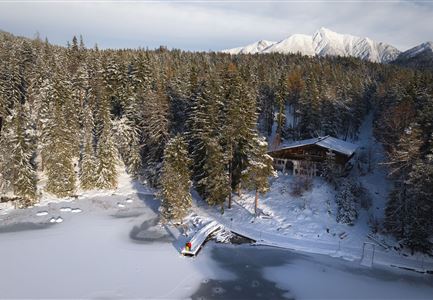
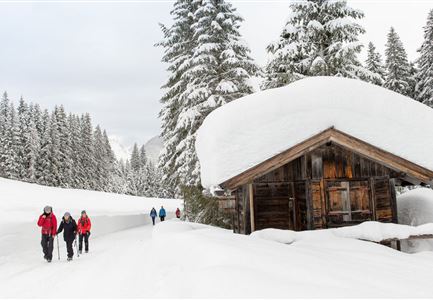
From parking lot P18 'Munde' near the Mundestadl in the Moos district of Leutasch, the marked hiking trail leads through a beautiful forest loop to the cozy Rauthhütte (1,605 m). Since there's a spectacular natural toboggan run from this traditional hut, you can take a sled with you for the way up.

The excellent cuisine at the Rauthhütte has even been awarded by the Gault-Millau gourmet guide and tempts ski tourers, hikers, and sledding guests in the winter months with delicious home-cooked meals and seasonal specialties.

Features & Characteristics

Start Point

Parking lot P18 'Munde'

End Point

Parking lot P18 'Munde'

Family-friendly

Yes

Similar Tour Suggestions

Winterwandern im Schnee (1) (3).jpg

Hiking

W21: Winter circular hike Fludertal - Katzenkopf

Length

8,02 km

Duration

02:45 h

Uphill

261 hm

Altitude

1369 hm

Difficulty

Medium

Open
Drohnenaufnahme Reith im Winter - Ortszentrum mit Kirche und Reither Spitze im Hintergrund.jpg

Hiking

W33: Winter circular hike Hölltal

Length

5,00 km

Duration

02:00 h

Uphill

192 hm

Downhill

186 hm

Altitude

1303 hm

Difficulty

Medium

Open
Winterwandern in Scharnitz_zwei Frauen laufen am Weg_Karwendel in der Distanz.jpg

Hiking

W22: Winter Hike from Scharnitz to Gießenbach

Length

6,70 km

Duration

01:50 h

Uphill

40 hm

Downhill

41 hm

Altitude

1009 hm

Difficulty

Easy

Open
Wettersteinhütte im Winter - Aufnahme von der Seite mit Sitzbänken.jpg

Hiking

W14: Winter hike to the Wettersteinhütte

Length

8,30 km

Duration

04:00 h

Uphill

504 hm

Altitude

1717 hm

Difficulty

Medium

Open
Winterwandern Paar Möserer See Drohnenaufnahme Paar steht am Steg mit Möserer Seestube und Reither Spitze im Hintergrund (1).jpg

Hiking

Stage 5: From Seefeld to Mösern and back to Seefeld via Wildmoos - Seefeld High Plateau Winter Multi-day Hike

Length

14,49 km

Duration

04:15 h

Uphill

247 hm

Downhill

246 hm

Altitude

1345 hm

Difficulty

Easy

Open
Winterwandern Paar Möserer See Paar steht auf Steg Seitenperspektive.jpg

Hiking

W27: Winter circular hike Möserer See

Length

3,50 km

Duration

01:15 h

Uphill

96 hm

Downhill

100 hm

Altitude

1297 hm

Difficulty

Easy

Open
Weitwandern Etappe 2 Teilnehmer am Weg bei Huette

Hiking

Stage 2: From Leutasch to Mösern – Tyrol’s 1. Winter Multi-day Hike

Length

16,00 km

Duration

05:00 h

Uphill

402 hm

Downhill

324 hm

Altitude

1393 hm

Difficulty

Medium

Open
Winterwandern Paar Möserer See Paar läuft durch Wald Aufnahme von hinten (2).jpg

Hiking

W3: Winter Circular Hike Seefeld-Mösern-Seefeld

Length

7,80 km

Duration

02:30 h

Uphill

183 hm

Downhill

179 hm

Altitude

1374 hm

Difficulty

Medium

Open