Tourismusverband Seefeld
We use cookies for your personalized browsing experience, to personalize content and ads, to provide social media features, and to analyze traffic to our website. We also share information about your use of our website with our social media, advertising and analytics partners. Our partners may combine this information with other data that you have provided to them or that they have collected as part of your use of the Services. (incl. US providers)

Start Point

Moos Rödlach parking lot (P11) - Leutasch

End Point

Moos Rödlach parking lot (P11) - Leutasch

Difficulty

Easy

Total Distance

5,30 km

Descent Meters

29 m

Highest Point

1177 m

Status

Open

Map & Elevation Profile

Start Point

Moos Rödlach parking lot (P11) - Leutasch

End Point

Moos Rödlach parking lot (P11) - Leutasch

Difficulty

Easy

Total Distance

5,30 km

Descent Meters

29 m

Highest Point

1177 m

Status

Open

Cross-country Skiing

Best Time

Open

Jan

Feb

Mar

Apr

May

Jun

Jul

Aug

Sep

Oct

Nov

Dec

Ski-nordic

Ski-nordic-classic

+6

Trail Entry Point:
At the Moos Rödlach P11 parking lot

Trail Character:
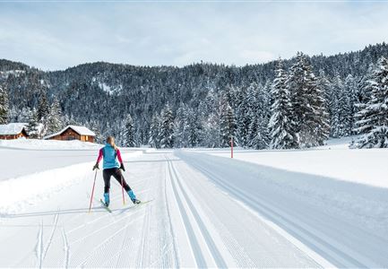
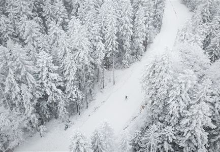
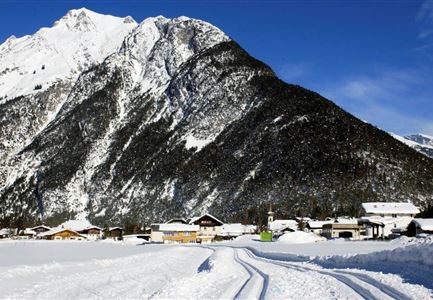
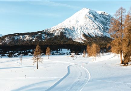
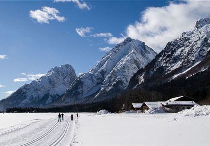
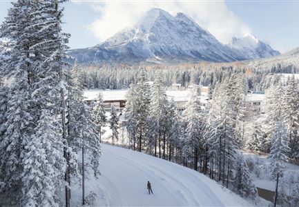
The A5 trail in Leutasch is an easy 5.3 km route, perfect for beginners or leisurely skiers. Sunny sections along forest edges and fields, combined with views of the Hohe Munde and the Wetterstein Mountains, create a unique natural experience. The trail begins at the Moos Rödlach parking lot (P11) and extends to the underpass in Ostbach. From there, you can either continue on the A6 trail towards Unterleutasch or return to the starting point. A cozy refreshment stop, the Mundestadl, offers a welcoming place to take a break. The parking lot features a waxing room and an accessible restroom.

Connecting Trails: 
A6 Alpenbad, B4 Skating Center, B5 Katzenloch, B7 Panorama (Classic), C7 Bichlwald, and C10 Mundeknie.
For an overview of the entire trail network (including trail status) and helpful cross-country skiing information (ticket machines, waxing and service points, changing facilities, etc.), refer to the trail report.

Features & Characteristics

Stamina

Technique

Start Point

Moos Rödlach parking lot (P11) - Leutasch

End Point

Moos Rödlach parking lot (P11) - Leutasch

Barrier-free/adaptive cross-country skiing

Yes

Skating

Yes

Klassisch

Yes

Similar Tour Suggestions

Ganghoferlauf_Leutasch_2022

Cross-country Skiing

Race Euroloppet Ganghoferlauf - skating 22 km

Length

22,00 km

Uphill

122 hm

Altitude

1199 hm

Difficulty

Hard

C3 Neuleutasch - Skating in Wildmoos

Cross-country Skiing

C3 – Neuleutasch

Length

5,10 km

Uphill

142 hm

Altitude

1335 hm

Difficulty

Hard

Closed
B1-Loipe-Moesern

Cross-country Skiing

B1 - Mösern

Length

5,50 km

Uphill

110 hm

Altitude

1228 hm

Difficulty

Medium

Open
Kaiser Maximilian Runde Seefeld

Cross-country Skiing

Adventure Run (classic & skating)

Length

55,00 km

Uphill

600 hm

Difficulty

Hard

Closed
Klassische Langlauf Spur

Cross-country Skiing

B8 - Interalpen Connection West

Length

400 m

Uphill

24 hm

Altitude

1342 hm

Difficulty

Medium

Open
Loipe A9 Unterleutasch

Cross-country Skiing

A9 - Unterleutasch

Length

13,70 km

Uphill

81 hm

Altitude

1092 hm

Difficulty

Easy

Open
C8 Rauthgatter Loipe - Buchen

Cross-country Skiing

C8 - Rauthgatter

Length

1,50 km

Uphill

77 hm

Altitude

1340 hm

Difficulty

Hard

Open
Loipe B11 Waldloipe Drohne

Cross-country Skiing

B11 – Waldloipe

Length

2,70 km

Uphill

51 hm

Altitude

1183 hm

Difficulty

Medium

Closed