We use cookies for your personalized browsing experience, to personalize content and ads, to provide social media features, and to analyze traffic to our website. We also share information about your use of our website with our social media, advertising and analytics partners. Our partners may combine this information with other data that you have provided to them or that they have collected as part of your use of the Services. (incl. US providers)

Start Point

Seefeld - Gießenbach

End Point

Seefeld - Gießenbach

Difficulty

Easy

Total Distance

10,70 km

Descent Meters

60 m

Highest Point

1037 m

Status

Closed

Map & Elevation Profile

Start Point

Seefeld - Gießenbach

End Point

Seefeld - Gießenbach

Difficulty

Easy

Total Distance

10,70 km

Descent Meters

60 m

Highest Point

1037 m

Status

Closed

Cross-country Skiing

Best Time

Closed

Jan

Feb

Mar

Apr

May

Jun

Jul

Aug

Sep

Oct

Nov

Dec

Adaptive nordic skiing

Ski-nordic

+6

Access to the ski track:

Parking Foodball Field

Connected tracks:

A12 | B9

An overview of the entire cross-country skiing network (incl. trail status) and helpful cross-country skiing information (ticket machines, waxing and service points, changing facilities, ...) can be found in the cross-country skiing report.

Track characteristics:

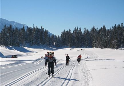
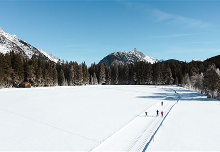
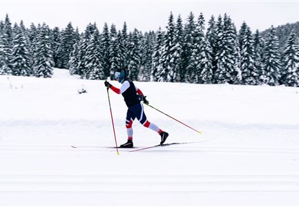
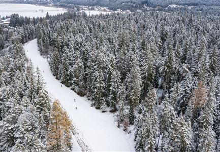
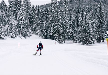
The A11 Bodenalm trail is a little-frequented track in a quiet location. Running parallel to the Drahnbach stream, it leads over pastures and through woodland. This trail is suitable for adaptive cross-country skiing.

Information:

During the early winter in particular, this area can be very cold indeed since the trail is located in a hollow. The Bodenalm hut is not managed in winter season.

Adaptive cross-country skiing is possible!

Refreshment stop:

Gasthof Ramona

Public transport:

The fastest public connection to the start of the cross-country skiing trail can be found directly in our route planner. Take the regional/ski bus to the stop "Scharnitz train station" (free bus use with guest card or cross-country skiing ticket). You can find all connections in real time with the Mobility-App "wegfinder".

Parking facility:

P7

Emergency call:

Tel.: 140

Features & Characteristics

Start Point

Seefeld - Gießenbach

End Point

Seefeld - Gießenbach

Barrier-free/adaptive cross-country skiing

Yes

Skating

Yes

Klassisch

Yes

Similar Tour Suggestions

Ganghoferlauf 2022

Cross-country Skiing

Race Euroloppet Ganghoferlauf - skating 42 km

Length

42,00 km

Uphill

203 hm

Altitude

1199 hm

Difficulty

Hard

B1-Loipe-Moesern

Cross-country Skiing

B1 - Mösern

Length

5,50 km

Uphill

110 hm

Altitude

1228 hm

Difficulty

Medium

Closed
B3 Wildmoos - Skating-Sprint am Stadl

Cross-country Skiing

B3 - Wildmoos See

Length

2,90 km

Uphill

49 hm

Altitude

1331 hm

Difficulty

Medium

Closed
Morgenstimmung im Wildmoos - Loipe C2

Cross-country Skiing

Olympia Track

Length

32,00 km

Uphill

589 hm

Difficulty

Hard

Loipe A9 Unterleutasch

Cross-country Skiing

A9 - Unterleutasch

Length

13,70 km

Uphill

81 hm

Altitude

1092 hm

Difficulty

Easy

Closed
C3 Neuleutasch - Skating in Wildmoos

Cross-country Skiing

C3 – Neuleutasch

Length

5,10 km

Uphill

142 hm

Altitude

1335 hm

Difficulty

Hard

Closed
B12 Abzweigung B1-B12

Cross-country Skiing

B12 - Mösern Ortszentrum

Length

1,00 km

Uphill

23 hm

Altitude

1248 hm

Difficulty

Medium

Closed
C10-Mundeknie-Loipe---Leutasch

Cross-country Skiing

C10 – Mundeknie

Length

2,50 km

Uphill

84 hm

Altitude

1263 hm

Difficulty

Hard

Closed