We use cookies for your personalized browsing experience, to personalize content and ads, to provide social media features, and to analyze traffic to our website. We also share information about your use of our website with our social media, advertising and analytics partners. Our partners may combine this information with other data that you have provided to them or that they have collected as part of your use of the Services. (incl. US providers)

Start Point

Seefeld Railway Station

End Point

Seefeld Railway Station

Difficulty

Easy

Total Distance

1,70 km

Descent Meters

30 m

Ascent Meters

39 m

Highest Point

1206 m

Total Time

00:30 h

Status

Open

Map & Elevation Profile

Start Point

Seefeld Railway Station

End Point

Seefeld Railway Station

Difficulty

Easy

Total Distance

1,70 km

Descent Meters

30 m

Ascent Meters

39 m

Highest Point

1206 m

Total Time

00:30 h

Status

Open

Hiking

Best Time

Open

Jan

Feb

Mar

Apr

May

Jun

Jul

Aug

Sep

Oct

Nov

Dec

Winter walking

Family-friendly

+1

A cozy winter walk around the Pfarrhügel and the Hotel Klosterbräu

The 100.000 Lights Path is a special highlight during the winter months, turning Seefeld’s snowy landscape into a warm, glowing wonderland. This circular walk combines nature, calm moments, and softly glowing light installations – especially magical in the evening hours.

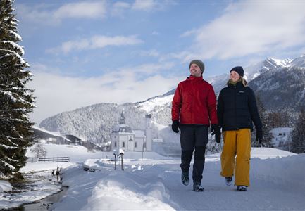
The walk starts in the heart of Seefeld’s town center. During Advent, a beautifully decorated Christmas tree and the sparkling Christmas market set the tone for what lies ahead. From here, the path leads left past the parish church, heading towards the Pfarrhügel (parish hill). Along the way, you’ll have a great view of the Hotel Klosterbräu and its expansive Garden of Eden. A short distance further, the trail branches to the right and gently winds downhill.

After two left-hand bends, you’ll arrive at the Olympiabad, where stunning light installations await in November and December. These artistic displays invite you to pause and soak up the atmosphere. From here, the path leads further downhill to the Seekirchl, its iconic silhouette beautifully lit up. During Advent, a large illuminated Advent wreath floats

Read More...

Features & Characteristics

Start Point

Seefeld Railway Station

End Point

Seefeld Railway Station

Family-friendly

Yes

Loop tour

Yes

Similar Tour Suggestions

Winterspatziergang mit Kindern - Katzenkopf Leutasch.jpg

Hiking

W20: Winter hike to the Katzenkopfhütte

Length

5,10 km

Duration

02:15 h

Uphill

231 hm

Altitude

1353 hm

Difficulty

Easy

Open
Winterweitwandern Fludertal

Hiking

W19: Winter hike Wildmoosalm - Fludertal

Length

16,20 km

Duration

05:00 h

Uphill

368 hm

Downhill

361 hm

Altitude

1335 hm

Difficulty

Easy

Open
Winterlicher Blick vom Wildsee Richtung Hohe Munde.jpg

Hiking

W7: Winter circular hike Reith - Seefeld - Reith

Length

8,70 km

Duration

02:30 h

Uphill

118 hm

Downhill

121 hm

Altitude

1200 hm

Difficulty

Easy

Open
Drohnenaufnahme Reith im Winter - Ortszentrum mit Kirche und Reither Spitze im Hintergrund.jpg

Hiking

W33: Winter circular hike Hölltal

Length

5,00 km

Duration

02:00 h

Uphill

192 hm

Downhill

186 hm

Altitude

1303 hm

Difficulty

Medium

Open
Winterwandern Paar Möserer See Paar läuft durch Wald Aufnahme von hinten (2).jpg

Hiking

W3: Winter Circular Hike Seefeld-Mösern-Seefeld

Length

7,80 km

Duration

02:30 h

Uphill

183 hm

Downhill

179 hm

Altitude

1374 hm

Difficulty

Medium

Open
Winterwandern Paar Oberer Wiesenweg Aufnahme von Paar von Hinten laufen neben Zaun (1).jpg

Hiking

Stage 4: From Wettersteinhütte to Leutasch – Tyrol’s 1. Winter Multi-day Hike

Length

9,50 km

Duration

03:30 h

Uphill

25 hm

Altitude

1717 hm

Difficulty

Medium

Open
Winterwandern-am-Wildmoos-Plateau-(1)_WaLogo.jpg

Hiking

W1: Winter Circular Hike Seefeld-Mösern-Wildmoos

Length

13,00 km

Duration

03:30 h

Uphill

247 hm

Altitude

1333 hm

Difficulty

Medium

Open
Funkelnd verschneite Felder vor Scharnitz.jpg

Hiking

W22: Winter Hike from Scharnitz to Gießenbach

Length

6,70 km

Duration

01:50 h

Uphill

40 hm

Downhill

41 hm

Altitude

1009 hm

Difficulty

Easy

Open