We use cookies for your personalized browsing experience, to personalize content and ads, to provide social media features, and to analyze traffic to our website. We also share information about your use of our website with our social media, advertising and analytics partners. Our partners may combine this information with other data that you have provided to them or that they have collected as part of your use of the Services. (incl. US providers)

Start Point

Leutasch Weidach

End Point

Leutasch Weidach

Difficulty

Hard

Total Distance

8,50 km

Descent Meters

259 m

Ascent Meters

259 m

Highest Point

1370 m

Map & Elevation Profile

Start Point

Leutasch Weidach

End Point

Leutasch Weidach

Difficulty

Hard

Total Distance

8,50 km

Descent Meters

259 m

Ascent Meters

259 m

Highest Point

1370 m

Cycling

Best Time

Jan

Feb

Mar

Apr

May

Jun

Jul

Aug

Sep

Oct

Nov

Dec

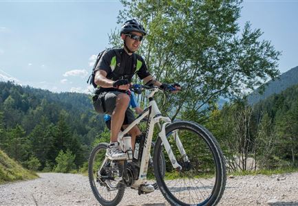
Mountainbike tour

Loop tour

Route: Leutasch/Weidach - Seewald - Katzenkopfhütte - Fludertal - Leutasch/Weidach

Route description:

This difficulty route starts in Leutasch/Weidach. Carefully cross the road and in front of the Pizzeria Il Tartufo follow the road until you reach the turn-off at Haus Rosa Munde. Turn left here and at the next junction turn right uphill through the Seewald settlement. At the top follow the signs to the Katzenkopfhütte, cross the slope and keep left again at the next junction. If you want, you still have the possibility here to make a small detour to the Katzenkopfhütte.

Follow the path to the next larger junction, here keep left again in the direction of Fludertal, follow the forest road until just before the main road, here take the path on the left back to Leutasch, past the valley station you then join the original path back to the starting point.

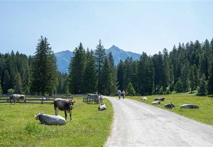
Attention pasture cattle, please keep distance and cross the pasture area calmly and quickly.

Alpine emergency call:

Call: 140

Features & Characteristics

Start Point

Leutasch Weidach

End Point

Leutasch Weidach

Loop tour

Yes

Similar Tour Suggestions

E-Bike-Pause-bei-Huette.jpg

Cycling

Bike-connection No. 546 Mösern-Seefeld

Length

10,10 km

Uphill

207 hm

Altitude

1292 hm

Difficulty

Medium

Gravelbike - Bikeweg im Gaistal.jpg

Cycling

Biketour No. 5047 Gaistal-Hämmermoosalm

Length

3,90 km

Uphill

171 hm

Downhill

172 hm

Altitude

1417 hm

Difficulty

Medium

Verbindung-Seefeld-Reith Pfarrhügel (c) Anna Rieder

Cycling

Bike-connection No. 5030 Seefeld-Reith

Length

10,20 km

Uphill

120 hm

Downhill

115 hm

Altitude

1193 hm

Difficulty

Easy

Wildmoosalm im Sommer - Hütte mit Kuh.jpg

Cycling

Gravelbiketour Wildmoos

Length

20,00 km

Uphill

450 hm

Altitude

1510 hm

Difficulty

Medium

Gravelbike - Anfahrt zur Gaistalalm

Cycling

Bike Trail Tirol Etappe 06: Ehrwald-Scharnitz

Length

40,00 km

Uphill

990 hm

Downhill

1020 hm

Altitude

1590 hm

Difficulty

Medium

Seebensee mit Raeder im Vordergrund

Cycling

Biketour No. 551 Seebensee

Length

27,60 km

Uphill

561 hm

Downhill

557 hm

Altitude

1581 hm

Difficulty

Medium

Gravelbiker auf dem Radweg durch das Leutaschtal im Sommer

Cycling

Biketour No. 537 through the Leutasch valley

Length

32,46 km

Uphill

200 hm

Downhill

205 hm

Altitude

1236 hm

Difficulty

Easy

Partially open
Triendlweg-Bauernwald Gasthaus Triendlsäge (c) Anna Rieder

Cycling

Biketour No. 535 Triendlweg-Bauernwald

Length

8,60 km

Uphill

217 hm

Altitude

1220 hm

Difficulty

Medium