We use cookies for your personalized browsing experience, to personalize content and ads, to provide social media features, and to analyze traffic to our website. We also share information about your use of our website with our social media, advertising and analytics partners. Our partners may combine this information with other data that you have provided to them or that they have collected as part of your use of the Services. (incl. US providers)

Start Point

Nature Park Information Centre Scharnitz (P2)

End Point

Nature Park Information Centre Scharnitz (P2)

Difficulty

Medium

Total Distance

8,60 km

Descent Meters

352 m

Highest Point

1144 m

Total Time

03:00 h

Map & Elevation Profile

Start Point

Nature Park Information Centre Scharnitz (P2)

End Point

Nature Park Information Centre Scharnitz (P2)

Difficulty

Medium

Total Distance

8,60 km

Descent Meters

352 m

Highest Point

1144 m

Total Time

03:00 h

Hiking

Best Time

Jan

Feb

Mar

Apr

May

Jun

Jul

Aug

Sep

Oct

Nov

Dec

Hiking tour

Circular hike

+2

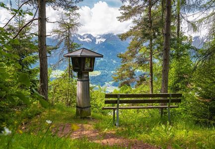
Route: Nature Park Information Centre Scharnitz (P2) - Birzl Chapel - Karwendelsteg - Nature Park Information Centre Scharnitz (P2)

Parking and public transport:

P2 "Karwendelparkplatz Länd".

By train to Scharnitz train station (10 minutes walk to the starting point).

You can find all connections in real time with the Mobility-App "wegfinder".

Directions:

From the Scharnitz Nature Park Info Center to the Isar promenade in the direction of the church. At the main road turn right over the Isar bridge. In front of the Café Reitherbrot turn right and follow the Inrainstraße. After the railroad overpass keep left and follow the Plattsteig. Orient yourself along the marked path until you reach the Birzl chapel. Pass the chapel until you reach the forest road of the Karwendel valley. There you walk in the direction of the Karwendelhaus until you reach a junction on the right to the Karwendelsteg. Follow the path until you reach the forest road towards Pleisenhütte. Here you turn right, direction Isarlodge Wiesenhof. From there you return to Scharnitz via the road.

Alpine emergency call:

Call: 140

Features & Characteristics

Refreshment stops

Start Point

Nature Park Information Centre Scharnitz (P2)

End Point

Nature Park Information Centre Scharnitz (P2)

Family-friendly

Yes

Loop tour

Yes

Similar Tour Suggestions

Grosse Arnspitze Blick ins Karwendel - Scharnitz

Hiking

Hike Hoher Sattel - Große Arnspitze Summit, 2,196 m

Length

10,30 km

Duration

08:00 h

Uphill

1313 hm

Altitude

2196 hm

Difficulty

Hard

Hofladenrunde Leutasch - Frau vor Wirtseppeler Hof.jpg

Hiking

Leutasch Farm Shop Circular Hike

Length

11,50 km

Duration

03:10 h

Uphill

111 hm

Downhill

108 hm

Altitude

1194 hm

Difficulty

Easy

Wanderer auf der Seefelder Spitze ueber Seefeld

Hiking

Bike & Hike Seefelder Spitze Summit, 2,220 m

Length

13,00 km

Duration

04:30 h

Uphill

1094 hm

Downhill

799 hm

Altitude

2220 hm

Difficulty

Hard

Isarursprung im Karwendel - Scharnitz (3).jpg

Hiking

Hike to the source of the river Isar & Kasten alpine hut

Length

28,20 km

Duration

06:00 h

Uphill

323 hm

Altitude

1227 hm

Difficulty

Easy

Reith im Frühling bei Morgenstimmung - Drohnenaufnahme Kirche mit Blick ins Inntal.jpg

Hiking

Cultural circular walking path Reith

Length

4,57 km

Duration

01:30 h

Uphill

113 hm

Altitude

1126 hm

Difficulty

Easy

Drohnenaufnahme Gschwandtkopf Speichersee - Person läuft entlang des Speichersees mit Hohe Munde im Hintergrund (3).jpg

Hiking

Hike on the Gschwandtkopf mountain

Length

11,60 km

Duration

03:30 h

Uphill

297 hm

Altitude

1485 hm

Difficulty

Medium

Hallerangeralm

Hiking

Bike & Hike Sunntigerspitze Summit, 2,321 m

Length

42,00 km

Duration

09:00 h

Uphill

1396 hm

Altitude

2321 hm

Difficulty

Medium

Pleisenhütte im Sommer - Scharnitz - quer.jpg

Hiking

Hike to the Pleisen alpine hut

Length

15,90 km

Duration

05:00 h

Uphill

780 hm

Downhill

774 hm

Altitude

1753 hm

Difficulty

Medium