We use cookies for your personalized browsing experience, to personalize content and ads, to provide social media features, and to analyze traffic to our website. We also share information about your use of our website with our social media, advertising and analytics partners. Our partners may combine this information with other data that you have provided to them or that they have collected as part of your use of the Services. (incl. US providers)

Start Point

Parking lot P5 'Salzbach' in Gaistal

End Point

Parking lot P5 'Salzbach' in Gaistal

Difficulty

Easy

Total Distance

9,70 km

Descent Meters

229 m

Ascent Meters

229 m

Highest Point

1404 m

Total Time

03:00 h

Map & Elevation Profile

Start Point

Parking lot P5 'Salzbach' in Gaistal

End Point

Parking lot P5 'Salzbach' in Gaistal

Difficulty

Easy

Total Distance

9,70 km

Descent Meters

229 m

Ascent Meters

229 m

Highest Point

1404 m

Total Time

03:00 h

Hiking

Best Time

Jan

Feb

Mar

Apr

May

Jun

Jul

Aug

Sep

Oct

Nov

Dec

Hiking tour

Hut hikes

+2

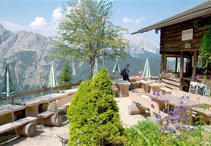
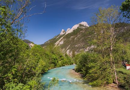
This easy hike in Gaistal gently undulates through open forest and passes by two rustic huts. The trail begins at the Salzbach parking lot (P3, P4, and P5) and, after about 200 meters of slight incline, leads to a relaxed section of the Ganghoferweg. This path runs below the Hämmermoosalm, offering beautiful views of the surrounding mountain landscape. After a while, you’ll reach the charming Gaistalalm, which invites you to rest and enjoy regional delicacies. From there, the trail continues to Tillfußalm, which is picturesquely located below the historic hunting lodge "Hubertus". This area exudes a special calm, inviting you to stop for a break before starting your return. The way back follows the same path, leading through the diverse and impressive natural scenery back to the starting point at the Salzbach parking lot.

Features & Characteristics

Start Point

Parking lot P5 'Salzbach' in Gaistal

End Point

Parking lot P5 'Salzbach' in Gaistal

Family-friendly

Yes

Stroller-friendly

Yes

Similar Tour Suggestions

Wanderung über der Karwendelschlucht - Scharnitz.jpg

Hiking

Circular hiking trail Karwendelschlucht/Karwendelsteg

Length

7,40 km

Duration

03:00 h

Uphill

266 hm

Altitude

1143 hm

Difficulty

Medium

Personen bei der Rotmoosalm im Sommer - auf der Terrasse (1).jpg

Hiking

Hike to the Rotmoosalm alpine hut

Length

9,00 km

Duration

05:30 h

Uphill

842 hm

Altitude

2037 hm

Difficulty

Medium

Blumenwiese in Neuleutasch

Hiking

Hike from Leutasch to Seefeld

Length

4,60 km

Duration

01:30 h

Uphill

118 hm

Downhill

83 hm

Altitude

1225 hm

Difficulty

Easy

Bodenalm Stall mit Brunnen

Hiking

Circular hiking traill to the Bodenalm alpine hut

Length

8,40 km

Duration

02:30 h

Uphill

180 hm

Altitude

1198 hm

Difficulty

Easy

Sonnenuntergang Hohe Munde_Ostgipfel

Hiking

Hike Hohe Munde Summit, 2.592 m

Length

11,30 km

Duration

09:00 h

Uphill

1410 hm

Altitude

2562 hm

Difficulty

Hard

Wanderung durchs Katzenloch im Frühherbst - Wanderer mit Hunde auf dem Weg bei einer Lichtung.jpg

Hiking

Hike through the Katzenloch

Length

7,10 km

Duration

02:00 h

Uphill

155 hm

Downhill

154 hm

Altitude

1280 hm

Difficulty

Easy

Seekirchl im Sommer - Seefeld

Hiking

Circular walk in the Möserer valley

Length

3,10 km

Duration

00:45 h

Uphill

12 hm

Altitude

1196 hm

Difficulty

Easy

Wettersteinhütte -Familientag in Leutasch im Somme

Hiking

Hike to the Wettersteinhütte alpine hut - Wang alpine hut

Length

7,30 km

Duration

04:00 h

Uphill

566 hm

Altitude

1717 hm

Difficulty

Medium