We use cookies for your personalized browsing experience, to personalize content and ads, to provide social media features, and to analyze traffic to our website. We also share information about your use of our website with our social media, advertising and analytics partners. Our partners may combine this information with other data that you have provided to them or that they have collected as part of your use of the Services. (incl. US providers)

Start Point

Seefeld Kurpark

End Point

Seefeld Kurpark

Difficulty

Easy

Total Distance

7,60 km

Descent Meters

36 m

Ascent Meters

32 m

Highest Point

1250 m

Total Time

02:00 h

Map & Elevation Profile

Start Point

Seefeld Kurpark

End Point

Seefeld Kurpark

Difficulty

Easy

Total Distance

7,60 km

Descent Meters

36 m

Ascent Meters

32 m

Highest Point

1250 m

Total Time

02:00 h

Hiking

Best Time

Jan

Feb

Mar

Apr

May

Jun

Jul

Aug

Sep

Oct

Nov

Dec

Thematic route

Hiking tour

+4

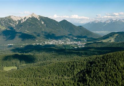
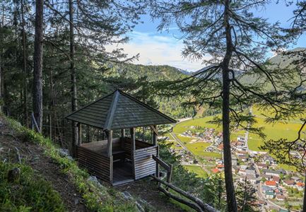
This tour offers a relaxing Kneipp experience around Seefeld. It starts at the Kurpark in the Village Center and leads through the town along Klosterstraße to the iconic Seekirchl. After crossing Möserer Straße, follow the path towards Kirchwald, passing the Tennis Hall, to the Kneipp spot ‘Lebensquelle.’ From there, continue to Möserer Straße, cross it again, and head back to Seefeld, passing the ski jumping hills.

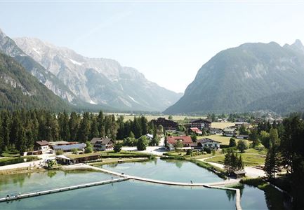
Through the Seefeld Sports Arena and the parking lot at Gschwandtkopf, go under the road and up to the Pfarrhügel and the inspiring Apostles' Circle. After a short moment of reflection, the path leads down to the road, which goes to the southern shore of Wildsee and the large Kneipp facility. The circular path around the lake will finally bring you back to the starting point.

Afterwards, the Seefeld Pedestrian Zone invites you for a relaxed stroll, or you can treat yourself to regional delicacies in one of the many restaurants.

Similar Tour Suggestions

Ausblick von der Arnplattenspitze auf die Gehrenspitze, Hohe Munde

Hiking

Circular hike Arnplattenspitze, 2,171 m

Length

8,60 km

Duration

07:00 h

Uphill

1106 hm

Altitude

2171 hm

Difficulty

Hard

Partially open
Wanderung zur Eppzirler Alm im Sommer - Mann und Frau von hinten mit Eppzirler Alm.jpg

Hiking

Circular hike via Eppzirler Alm and Nördlinger hut to Seefeld

Length

20,40 km

Duration

10:00 h

Uphill

1464 hm

Altitude

2231 hm

Difficulty

Hard

Brunnsteinspitze mit Gipfelkreuz - Scharnitz (4).jpg

Hiking

Hike to the Brunnsteinspitze Summit, 2,180 m

Length

12,70 km

Duration

08:30 h

Uphill

1454 hm

Altitude

2180 hm

Difficulty

Hard

Wandern am Brunschkopf

Hiking

Brunschkopf viewing platform via Wildmoosalm from Leutasch

Length

12,80 km

Duration

04:30 h

Uphill

441 hm

Downhill

438 hm

Altitude

1493 hm

Difficulty

Medium

Katzenkopfhuette mit Blumenwiese im Sommer

Hiking

Hike to the Katzenkopfhütte alpine hut

Length

5,20 km

Duration

02:00 h

Uphill

243 hm

Altitude

1360 hm

Difficulty

Easy

Gleirschklamm - Scharnitz (17).jpg

Hiking

Hike through the Gleirschklamm to the Möslalm

Length

21,20 km

Duration

06:30 h

Uphill

505 hm

Downhill

498 hm

Altitude

1261 hm

Difficulty

Medium

Sonnenaufgang im Karwendel_Speckkarspitze

Hiking

Bike & Hike Speckkarsptitze, 2,621 m

Length

44,00 km

Duration

11:00 h

Uphill

1794 hm

Altitude

2621 hm

Difficulty

Hard

Durch die Gleirschklamm bei Scharnitz.jpg

Hiking

Circular hiking trail Gleirschklamm Gorge

Length

13,10 km

Duration

04:00 h

Uphill

416 hm

Downhill

410 hm

Altitude

1152 hm

Difficulty

Medium