We use cookies for your personalized browsing experience, to personalize content and ads, to provide social media features, and to analyze traffic to our website. We also share information about your use of our website with our social media, advertising and analytics partners. Our partners may combine this information with other data that you have provided to them or that they have collected as part of your use of the Services. (incl. US providers)

Start Point

Scharnitz Nature Park Info Center (P2)

End Point

Scharnitz Nature Park Info Center (P2)

Difficulty

Medium

Total Distance

2,80 km

Descent Meters

230 m

Ascent Meters

230 m

Highest Point

1145 m

Total Time

01:30 h

Map & Elevation Profile

Start Point

Scharnitz Nature Park Info Center (P2)

End Point

Scharnitz Nature Park Info Center (P2)

Difficulty

Medium

Total Distance

2,80 km

Descent Meters

230 m

Ascent Meters

230 m

Highest Point

1145 m

Total Time

01:30 h

Hiking

Best Time

Jan

Feb

Mar

Apr

May

Jun

Jul

Aug

Sep

Oct

Nov

Dec

Hiking tour

Family-friendly

Route: Scharnitz Nature Park Info Center - Adlerkanzel - Scharnitz Nature Park Info Center

Parking and public transport:

P2 "Karwendelparkplatz Länd".

By train to Scharnitz train station (10 minutes walk to the starting point).

You can find all connections in real time with the Mobility-App "wegfinder".

Directions:

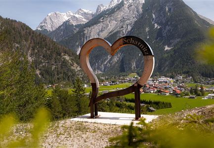
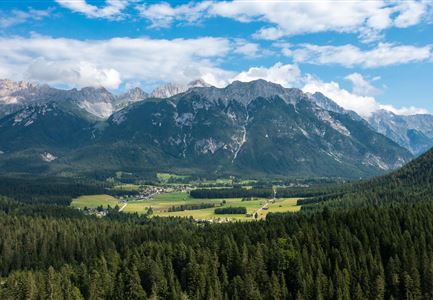
From the Nature Park Info Center Scharnitz along the Auweg over the Isar bridge to the left. Continue along the Inrainstraße. Shortly before the railroad overpass, turn right and follow the signs to the Adlerkanzel. At the junction in the road with a bench, keep left and continue along the marked path in serpentines - sometimes steep - up to the "Adlerkanzel" viewpoint pavilion. Wonderful panoramic view over the entire village. Return along the same route.

Alpine emergency call:

Call: 140

Features & Characteristics

Start Point

Scharnitz Nature Park Info Center (P2)

End Point

Scharnitz Nature Park Info Center (P2)

Family-friendly

Yes

Similar Tour Suggestions

Bikepause an der Isarquelle.jpg

Hiking

Bike & Hike Halleranger house - Halleranger alm

Length

38,00 km

Duration

06:00 h

Uphill

832 hm

Altitude

1768 hm

Difficulty

Medium

Leutascher Geisterklamm mit Blick Richtung Mittenwald.jpg

Hiking

Long Gorge Trail through the Leutasch Spirit Gorge with Themed Trail

Length

3,20 km

Duration

01:30 h

Uphill

129 hm

Downhill

127 hm

Altitude

1060 hm

Difficulty

Medium

Closed
Meilerhütte

Hiking

Hike to the Meilerhütte alpine hut

Length

13,00 km

Duration

09:00 h

Uphill

1352 hm

Downhill

36 hm

Altitude

2371 hm

Difficulty

Medium

Reith - Wanderung Frau Häusl Kapelle - Frau Häusl Kapelle mit Farn im Vordergrund.jpg

Hiking

On the rosary walking trail to the Frau Häusl chapel

Length

1,20 km

Duration

01:15 h

Uphill

100 hm

Altitude

1220 hm

Difficulty

Easy

Wanderung über der Karwendelschlucht - Scharnitz.jpg

Hiking

Circular hiking trail Karwendelschlucht/Karwendelsteg

Length

7,40 km

Duration

03:00 h

Uphill

266 hm

Altitude

1143 hm

Difficulty

Medium

Spaziergang mit Hund in Unterleutasch - Mann läuft mit Hund entlang von Bäumen Aufnahme Richtung Sonne.jpg

Hiking

Hike to Unterleutasch

Length

9,10 km

Duration

02:30 h

Uphill

3 hm

Downhill

77 hm

Altitude

1174 hm

Difficulty

Easy

Partially open
Nördlinger Hütte - Wanderer kurz vor der Hütte (2).jpg

Hiking

Circular hike to the Nördlinger Hütte alpine hut & Reither Spitze Summit, 2,374m

Length

9,90 km

Duration

07:30 h

Uphill

1191 hm

Altitude

2374 hm

Difficulty

Hard

Personen bei der Rotmoosalm im Sommer - auf der Terrasse (1).jpg

Hiking

Hike to the Rotmoosalm alpine hut

Length

9,00 km

Duration

05:30 h

Uphill

842 hm

Altitude

2037 hm

Difficulty

Medium