Start Point

Naturpark-Infozentrum Scharnitz

End Point

Reith bei Seefeld

Difficulty

Easy

Total Distance

18,50 km

Descent Meters

320 m

Ascent Meters

140 m

Highest Point

1200 m

Total Time

01:45 h

Status

Partially open

Map & Elevation Profile

Start Point

Naturpark-Infozentrum Scharnitz

End Point

Reith bei Seefeld

Difficulty

Easy

Total Distance

18,50 km

Descent Meters

320 m

Ascent Meters

140 m

Highest Point

1200 m

Total Time

01:45 h

Status

Partially open

Cycling

Best Time

Partially open

Jan

Feb

Mar

Apr

May

Jun

Jul

Aug

Sep

Oct

Nov

Dec

Mountainbike tour

Attention: The access road to Gschwandtkopf from Reith is closed for one week due to forestry work.

Route: Scharnitz - Giessenbach - Bodenalm - Triendlsäge - Seefeld train station - Wildsee - Seewald - Reith - bee trail - Reith train station - Innsbruck

Route description:
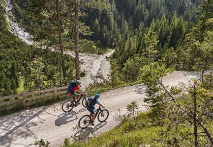
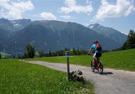
Right after the border to Bavaria we use the new underpass under the state road B177 and get safely to the traffic-calmed village Scharnitz, past the train station to the church. Here you have access to the wonderful mountain bike tours into the Karwendel.
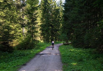
We keep straight on in the direction of Seefeld, through a pine forest to the industrial area of Giessenbach. Attention: here we have to use the little frequented road towards Leutasch for about 1 km. Then we turn left again onto the forest path towards Seefeld, the path runs along the "Boden" on the right, after about 2 km we can make a detour to the left side of the valley and pass the cosy Bodenalm (fresh milk, butter and cheese), but the cycle path remains on the right side of the valley. Well signposted you will soon reach the forest inn Triendlsäge.
Over a slight incline the route continues towards

Read More...

Features & Characteristics

Start Point

Naturpark-Infozentrum Scharnitz

End Point

Reith bei Seefeld

Videos

01

Similar Tour Suggestions

Radfahrer unterwegs im Gaistal mit Blick auf die Leutascher Ache

Cycling

Biketour No. 552 Gaistal-Hochfeldern Alm

Length

20,20 km

Duration

02:00 h

Uphill

539 hm

Downhill

536 hm

Altitude

1733 hm

Difficulty

Hard

Gravelbiker bei der Wildmoosalm im Sommer

Cycling

Biketour No. 547 Wildmoos-Buchen

Length

8,80 km

Duration

00:25 h

Uphill

184 hm

Downhill

183 hm

Altitude

1346 hm

Difficulty

Medium

Gravelbiker in Scharnitz im Sommer

Cycling

Bike-connection No. 5051 Seefeld-Scharnitz

Length

25,30 km

Duration

01:15 h

Uphill

256 hm

Downhill

250 hm

Altitude

1195 hm

Difficulty

Medium

Wildmoos (c) Anna Rieder

Cycling

Biketour No. 5069 Seefeld-Wildmoos

Length

6,30 km

Duration

00:30 h

Uphill

122 hm

Downhill

120 hm

Altitude

1308 hm

Difficulty

Medium

Reith-Wiesenwegrunde (c) Anna Rieder

Cycling

Biketour No. 5031 Reith-Wiesenweg

Length

4,60 km

Duration

00:35 h

Uphill

109 hm

Downhill

110 hm

Altitude

1129 hm

Difficulty

Medium

Katzenkopf (c) Anna Rieder

Cycling

Biketour No. 541 Katzenkopf-Fluder

Length

8,50 km

Duration

01:10 h

Uphill

259 hm

Altitude

1370 hm

Difficulty

Hard

Erfrischende Rast an den Isarquellen

Cycling

Biketour No. 578 Hinterautal-Isarursprung-Kastenalm

Length

28,30 km

Duration

02:30 h

Uphill

327 hm

Downhill

324 hm

Altitude

1220 hm

Difficulty

Easy

Gravelbikerin fährt vom Gaistal Richtung Leutasch.jpg

Cycling

Bikeroute No. 5080 Rauthhütte

Length

5,00 km

Duration

01:20 h

Uphill

423 hm

Downhill

416 hm

Altitude

1601 hm

Difficulty

Hard