Start Point

Information Office Mösern

End Point

Information Office Mösern

Difficulty

Easy

Total Distance

4,40 km

Descent Meters

92 m

Ascent Meters

92 m

Highest Point

1289 m

Total Time

01:00 h

Map & Elevation Profile

Start Point

Information Office Mösern

End Point

Information Office Mösern

Difficulty

Easy

Total Distance

4,40 km

Descent Meters

92 m

Ascent Meters

92 m

Highest Point

1289 m

Total Time

01:00 h

Running

Best Time

Jan

Feb

Mar

Apr

May

Jun

Jul

Aug

Sep

Oct

Nov

Dec

Nordic walking

Running tracks

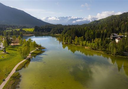
This village running loop showcases the best of Mösern – the largest free-standing bell in the Alps and the idyllic Möserer See. In summer, the lake reaches up to 25°C, making it one of the warmest swimming lakes in Tyrol. In winter, depending on the weather, it turns into a popular ice-skating spot on weekends.

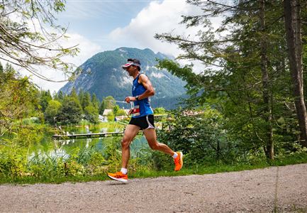
The loop starts at the Mösern information office and is suitable for running all year round. Right at the beginning, the route passes a 300-year-old local farm museum. Shortly after, it reaches the small Gföll Chapel. After crossing the road, the trail continues on the Albrecht-Dürer-Weg, a scenic section that leads into nature.

Before long, Möserer See comes into view. Sitting at 1,295 meters above sea level and surrounded by dense pine forest, it is a peaceful swimming spot in summer with pleasantly warm temperatures. Benches along the shore invite runners to pause and take in the view.

In winter, the landscape transforms into a snowy wonderland. If the ice is thick enough, the lake becomes an ice-skating rink. After a loop around the lake, the route continues to the Peace Bell. Weighing 10,450 kilograms, it

Read More...

Similar Tour Suggestions

Scharnitz - Wanderung Dorfrunde - Weg von Gießenbach nach Scharnitz mit Läufer.jpg

Running

Village Running Loop Scharnitz

Length

8,30 km

Duration

02:00 h

Uphill

42 hm

Altitude

1010 hm

Difficulty

Easy

Trailrunning in der Region Seefeld - Läuferinnen in Seefeld - Fußgängerzone.jpg

Running

Village Running Loop Seefeld

Length

4,90 km

Duration

01:00 h

Uphill

22 hm

Altitude

1207 hm

Difficulty

Easy

Ganghofertrail 2024 - einzelzer Läufer im Wald bei Weidachsee.jpg

Running

Moos Running Route

Length

8,70 km

Duration

01:00 h

Uphill

104 hm

Downhill

100 hm

Altitude

1188 hm

Difficulty

Easy

Trailrunning in der Region Seefeld - Abkühlung an der Leutascher Ache - Gaistal.jpg

Running

Village Running Loop Leutasch

Length

6,20 km

Duration

01:45 h

Uphill

73 hm

Altitude

1195 hm

Difficulty

Easy

Wildsee im Frühling bei Morgenstimmung - Drohnenaufnahme Seepromenade.jpg

Running

Auland Running Route

Length

8,90 km

Duration

02:30 h

Uphill

128 hm

Altitude

1200 hm

Difficulty

Medium

Skisprungschanzen kurz vorm Sonnenuntergang (1).jpg

Running

Stadium Running Route

Length

3,00 km

Duration

00:45 h

Uphill

50 hm

Altitude

1202 hm

Difficulty

Easy

Reith Wiesenweg im Frühling - Weg entlang grüner Wiesen.jpg

Running

Village Running Loop Reith

Length

4,60 km

Duration

01:30 h

Uphill

105 hm

Altitude

1128 hm

Difficulty

Easy

Ganghofertrail 2024 - einzelner Läufer bei Weidachsee mit Blick auf Arnspitzen.jpg

Running

Weidachsee Running Route

Length

3,70 km

Duration

00:50 h

Uphill

63 hm

Downhill

64 hm

Altitude

1156 hm

Difficulty

Easy