Start Point

Leutasch - Schanz

End Point

Schanz Leutasch

Difficulty

Easy

Total Distance

1,20 km

Descent Meters

9 m

Highest Point

1021 m

Status

Closed

Map & Elevation Profile

Start Point

Leutasch - Schanz

End Point

Schanz Leutasch

Difficulty

Easy

Total Distance

1,20 km

Descent Meters

9 m

Highest Point

1021 m

Status

Closed

Cross-country Skiing

Best Time

Closed

Jan

Feb

Mar

Apr

May

Jun

Jul

Aug

Sep

Oct

Nov

Dec

Ski-nordic

Ski-nordic-classic

+6

Access to the ski track:

Schanz area of Leutasch (Klammgeist inn)

Connected track:

A9

An overview of the entire cross-country skiing network (incl. trail status) and helpful cross-country skiing information (ticket machines, waxing and service points, changing facilities, ...) can be found in the cross-country skiing report.

Track characteristics:

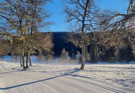
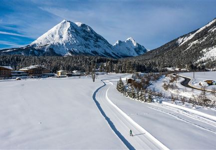
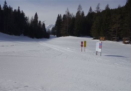
The ‘Bärenwirt’ trail is a short, easy circular track ideally suited to beginners. Situated opposite the Bärenwirt and Klammgeist inns (turning point) are the ruins of the Porta Claudia, the former fortification on the border between Bavaria and Tyrol (former customs office). You can also catch a glimpse of the Ederkanzel mountain tavern. Here at the end of the Leutasch valley you an also find out all about the legendary ‘Spirit of the Gorge’! If you don’t want to ski back to the starting point, you can take the bus instead. A regular bus service runs between the Bärenwirt/Klammgeist bus stop and Gasse/Weidach.

Information:

Adaptive cross-country skiing is possible!


Refreshment stops:

Leutascher Klammstüberl

Public transport:

The fastest public connection to the start of the cross-country skiing trail can be found directly in our route planner. Take the regional/ski bus to the stop "Schanz" (free bus use with guest card or cross-country skiing ticket).

Emergency call:

Tel.:

Read More...

Features & Characteristics

Start Point

Leutasch - Schanz

End Point

Schanz Leutasch

Barrier-free/adaptive cross-country skiing

Yes

Skating

Yes

Klassisch

Yes

Similar Tour Suggestions

Langlaufen auf der C11

Cross-country Skiing

C11 - Lottensee

Length

3,40 km

Uphill

99 hm

Altitude

1332 hm

Difficulty

Hard

Closed
Luftaufnahme der Loipe A10 Weidach mit Langlaeuferin und Hoher Munde.jpg

Cross-country Skiing

A10 – Weidach

Length

1,70 km

Uphill

14 hm

Altitude

1120 hm

Difficulty

Easy

Closed
Loipe bei der Ropferstub'm mit Blick ins Inntal - Moesern-Buchen

Cross-country Skiing

B5 - Katzenloch

Length

5,00 km

Uphill

67 hm

Altitude

1260 hm

Difficulty

Medium

Closed
Snowfarming Loipe Leutasch

Cross-country Skiing

A6 - Snowfarming track Leutasch

Length

2,80 km

Uphill

21 hm

Altitude

1153 hm

Difficulty

Easy

Closed
Klassische Langlauf Spur

Cross-country Skiing

B8 - Interalpen Connection West

Length

400 m

Uphill

24 hm

Altitude

1342 hm

Difficulty

Medium

Closed
B7 Klassisch.jpg

Cross-country Skiing

B9 - Triendlsäge

Length

3,00 km

Uphill

-120 hm

Altitude

1163 hm

Difficulty

Medium

Closed
B12 Abzweigung B1-B12

Cross-country Skiing

B12 - Mösern Ortszentrum

Length

1,00 km

Uphill

23 hm

Altitude

1248 hm

Difficulty

Medium

Closed
Seefeld Nachtloipe A7 mit Seekirchl zur Blauen Stunde.jpg

Cross-country Skiing

A1 - Nachtloipe - flood light trail

Length

3,00 km

Uphill

19 hm

Altitude

1189 hm

Difficulty

Easy

Closed