View into the distance
Brunschkopf Viewing Platform
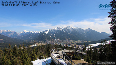
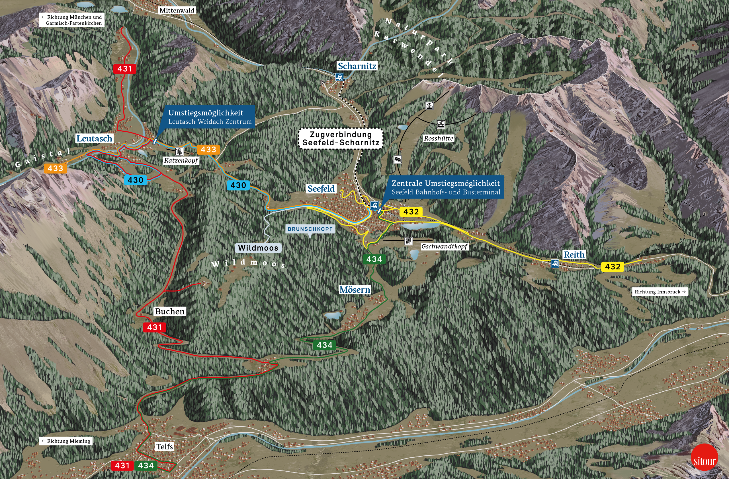
There are many lovely trails leading to the Brunschkopf viewing platform. Depending where you choose to start, you can walk (or cycle) from Mösern, Seefeld or Leutasch to the viewing platform, which sits at 1,510 metres above sea level. Once there, you can look through the top-quality Swarovski telescope located on the modern wooden platform and enjoy crystal-clear views of Seefeld, the Wetterstein range, the top of the Hohe Munde and the surrounding mountain peaks. Or, you can just find yourself a quiet spot in the sun to relax and take in the scenery. You can choose between the various routes up and down and make your own individual circular tour as you see fit, taking in some mountain bathing lakes, rare natural phenomena, idyllic protected areas, and various traditional huts and alms along the way.
Important notes
- Open all year round (but note the current weather conditions, temporary closures are possible).
- We recommend public transport (guest card = public transport ticket) to the respective starting point (Seefeld, Leutasch or Mösern). Detailed information is available in the corresponding tour descriptions.
- The hiking trail from the Brunschkopf viewing platform via Geiernest and back via Wildmoosalm is certified with the Austrian Hiking Quality Seal.
Paths to the Panorama
Discover our hiking trails to the Brunschkopf


AUSTRIAN HIKING SEAL OF QUALITY
Certified hiking trail
Snow paths
Discover our winter snowshoe tour to Brunschkopf

Brunschkopf trails
Discover our bike tour to the Brunschkopf

Magical moments at the Brunschkopf
Sunrise on the Brunschkopf
Higher up
The construction of the viewing platform
In 2017, a new viewing platform was opened on the Brunschkopf. This platform is a real highlight, as it is harmoniously embedded in the surrounding nature and offers hikers and nature lovers a wonderful view of the Tyrolean Alps.
SIMPLY ARRIVE
Arriving to the hiking and biking starting points
You can easily reach the Brunschkopf viewing platform via a hiking trail or bike trail. You can use public transport (guest card = public transport ticket) or the car to get to the respective starting point in Seefeld, Leutasch or Mösern. Detailed information is available in the corresponding tour descriptions.
Webcam