We use cookies for your personalized browsing experience, to personalize content and ads, to provide social media features, and to analyze traffic to our website. We also share information about your use of our website with our social media, advertising and analytics partners. Our partners may combine this information with other data that you have provided to them or that they have collected as part of your use of the Services. (incl. US providers)

Start Point

Parkplatz P6 Hoher Sattel

End Point

Parkplatz P6 Hoher Sattel

Difficulty

Hard

Total Distance

2,70 km

Ascent Meters

350 m

Total Time

01:30 h

Status

Closed

Map & Elevation Profile

Start Point

Parkplatz P6 Hoher Sattel

End Point

Parkplatz P6 Hoher Sattel

Difficulty

Hard

Total Distance

2,70 km

Ascent Meters

350 m

Total Time

01:30 h

Status

Closed

Sledding

Best Time

Closed

Jan

Feb

Mar

Apr

May

Jun

Jul

Aug

Sep

Oct

Nov

Dec

Tobogganing

Type: Naturrodelbahn

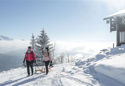
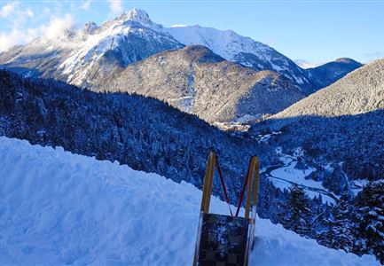
The tobogganing track at Hoher Sattel is a true insider tip for experienced and athletic riders. Over the 2.5 km to the highest point, you’ll tackle a challenging 385 meters of elevation gain. The reward? A thrilling sledding ride back down to the valley, with an average gradient of around 14%.

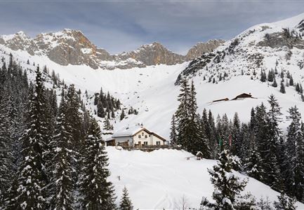
The ascent starts directly from the parking lot in Ahrn and heads east into the Satteltal valley. Follow the signs, and after about an hour of hiking—watch out for sledders and hikers coming the other way—you’ll reach the highest point of the tour at 1,495 meters. There aren’t any refreshment spots along the way, but the winter stillness creates the perfect setting for a picnic you bring yourself. Then, it’s time to hop on your toboggan for the descent.

Snow conditions can make parts of the descent quite icy, so it’s important to gauge the difficulty during your climb. Adjust your speed and ride carefully, especially on the steeper sections—mastery of braking and steering is essential here.

Key facts about the tobogganing track:
• Length: approx. 2.5 km
• Elevation gain: 385 m
• Lift assistance: none
• Lighting: none

Important note: This tobogganing track is a challenge, even for seasoned riders! For families, beginners, or kids, we

Read More...

Features & Characteristics

Stamina

Technique

Start Point

Parkplatz P6 Hoher Sattel

End Point

Parkplatz P6 Hoher Sattel

Type

Naturrodelbahn

Similar Tour Suggestions

Rodeln in der Region Seefeld - Vater mit Sohn - High Five.jpg

Sledding

Toboggan run Katzenkopfhütte

Length

2,50 km

Duration

01:00 h

Downhill

200 hm

Difficulty

Medium

Closed
Rodelhügel Seefeld_Familie fährt den Hügel hinab.jpg

Sledding

Toboggan hill Seefeld

Length

118 m

Downhill

10 hm

Difficulty

Easy

Open
Haemmermoosalm im Winter.jpg

Sledding

Toboggan run Hämmermoos

Length

2,00 km

Duration

00:45 h

Downhill

220 hm

Difficulty

Medium

Open
Drohnenaufnahme Wettersteinhütte - Blick durch Bäume Richtung Wettersteingebirge.jpg

Sledding

Toboggan run Wettersteinhütte

Length

3,90 km

Duration

01:30 h

Downhill

550 hm

Difficulty

Hard

Closed
Aufstieg zur Rauthhuette mit Rodel - Leutasch (4).jpg

Sledding

Toboggan run Rauthhütte

Length

2,50 km

Duration

01:30 h

Downhill

425 hm

Difficulty

Hard

Open
Muehlberg in Scharnitz

Sledding

Toboggan run Mühlberg

Length

3,10 km

Duration

01:30 h

Downhill

340 hm

Difficulty

Medium

Closed
Berg-Brunch - Zottlhof Leutasch - gemeinsam Rodeln mit Munde.jpg

Sledding

Toboggan run Kreidegraben Scharnitz

Length

1,20 km

Duration

01:00 h

Downhill

134 hm

Difficulty

Medium

Closed