We use cookies for your personalized browsing experience, to personalize content and ads, to provide social media features, and to analyze traffic to our website. We also share information about your use of our website with our social media, advertising and analytics partners. Our partners may combine this information with other data that you have provided to them or that they have collected as part of your use of the Services. (incl. US providers)

Start Point

Leutasch Schanz

End Point

Leutasch Music Pavilion

Difficulty

Medium

Total Distance

14,20 km

Descent Meters

140 m

Ascent Meters

58 m

Highest Point

1162 m

Total Time

03:30 h

Status

Open

Map & Elevation Profile

Start Point

Leutasch Schanz

End Point

Leutasch Music Pavilion

Difficulty

Medium

Total Distance

14,20 km

Descent Meters

140 m

Ascent Meters

58 m

Highest Point

1162 m

Total Time

03:30 h

Status

Open

Hiking

Best Time

Open

Jan

Feb

Mar

Apr

May

Jun

Jul

Aug

Sep

Oct

Nov

Dec

Winter walking

For a multi-day hiking adventure, it’s important to take your time and arrive early. If you come the night before, you can enjoy the atmosphere of the Seefeld Plateau and start the first leg of your journey the next morning, well-rested and full of energy.

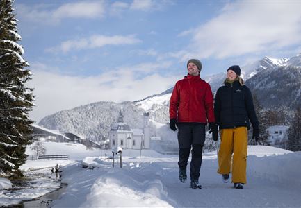
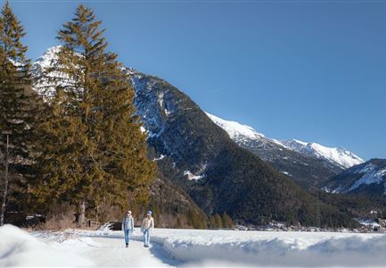
The first section of Tyrol's first long-distance winter hiking trail leads through the picturesque Leutasch Valley. The starting point of the long-distance winter hike is in the district of Schanz - you can get there either by bus (bus stop ‘Schanz’) or by car. The car park (limited parking spaces), which is located directly in Schanz behind the information hut, is prepared exclusively for guests of the winter hiking trail and requires a parking permit, which is sent free of charge in advance via the Leutasch information office. From the bus stop or the car park, continue along the main road for approx. 150 metres to restaurant Mühle (Burggraben 264), where you can drop off your luggage. The route then continues in a curve to the right past the restaurant Mühle into the long Achweg.
Here the route first runs along the edge of the forest and then through the forest, almost always alongside the water. A beautiful

Read More...

Similar Tour Suggestions

Winterwandern Paar Seefeld Möserer Tal Mann zeigt auf Seekirchel.jpg

Hiking

Stage 1: From Seefeld via Reith to Leithen - Seefeld High Plateau Winter Multi-day Hike

Length

12,80 km

Duration

05:00 h

Uphill

266 hm

Downhill

267 hm

Difficulty

Easy

Open
Winterwandern-am-Wildmoos-Plateau-(1)_WaLogo.jpg

Hiking

W1: Winter Circular Hike Seefeld-Mösern-Wildmoos

Length

13,00 km

Duration

03:30 h

Uphill

247 hm

Altitude

1333 hm

Difficulty

Medium

Open
drohnenaufnahme_neuschnee_27.11._leutasch_blick_richtung_hohe_munde_1.jpg

Hiking

W10: Winter hike through the Leutasch Valley

Length

26,40 km

Duration

07:00 h

Uphill

173 hm

Downhill

177 hm

Altitude

1179 hm

Difficulty

Easy

Closed
Katzenkopfhütte Winter

Hiking

Stage 1: Extension to Katzenkopf (2.9 km) – Tyrol’s 1. Winter Multi-day Hike

Length

2,90 km

Duration

01:15 h

Uphill

245 hm

Altitude

1360 hm

Difficulty

Medium

Open
Luftaufnahme Wildsee im Winter - Seefeld.jpg

Hiking

W5: Winter Circuite around the Wildsee lake

Length

4,70 km

Duration

01:15 h

Uphill

22 hm

Altitude

1181 hm

Difficulty

Easy

Open
Weitwandern Etappe 3 Winterlandschaft (1).jpg

Hiking

W28: Winter Circular Hike Mösern-Wildmoosalm-Lottenseehütte

Length

11,00 km

Duration

03:15 h

Uphill

221 hm

Downhill

222 hm

Altitude

1366 hm

Difficulty

Easy

Open
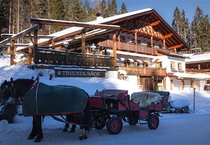
Triendlsäge im Winter - Gebäude mit Pferdekutsche.jpg

Hiking

W4: Winter Circular Hike Seefeld - Triendlsäge

Length

7,50 km

Duration

02:15 h

Uphill

147 hm

Altitude

1198 hm

Difficulty

Easy

Open
Leutasch - Winterwanderweg 15 Katzenloch-3.jpg

Hiking

Stage 2: From Seefeld to Scharnitz - Seefeld High Plateau Winter Multi-day Hike

Length

12,37 km

Duration

03:30 h

Uphill

59 hm

Downhill

278 hm

Altitude

1182 hm

Difficulty

Easy

Open