We use cookies for your personalized browsing experience, to personalize content and ads, to provide social media features, and to analyze traffic to our website. We also share information about your use of our website with our social media, advertising and analytics partners. Our partners may combine this information with other data that you have provided to them or that they have collected as part of your use of the Services. (incl. US providers)

Start Point

Leutasch parking Salzbach (P5)

End Point

Corburgerhütte

Difficulty

Medium

Total Distance

31,00 km

Descent Meters

820 m

Ascent Meters

815 m

Highest Point

1897 m

Total Time

04:45 h

Map & Elevation Profile

Start Point

Leutasch parking Salzbach (P5)

End Point

Corburgerhütte

Difficulty

Medium

Total Distance

31,00 km

Descent Meters

820 m

Ascent Meters

815 m

Highest Point

1897 m

Total Time

04:45 h

Hiking

Best Time

Jan

Feb

Mar

Apr

May

Jun

Jul

Aug

Sep

Oct

Nov

Dec

Hiking tour

Bike & Hike

Route: Car Park Leutasch Salzbach – Forest road untill Lake Igelsee – Alpine Hut Seebenalm - hut Coburgerhütte - Lake Drachensee

Nature jewel: The Gaistal and the lake Seebensee

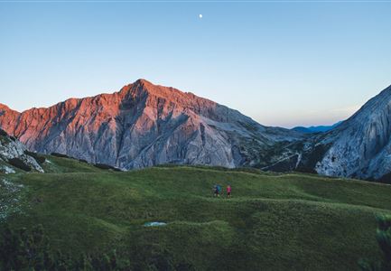
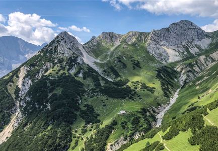
In 2017 this little paradise was voted the most beautiful place in Tyrol in the tv-show 9 places, 9 treasures. The Gaistal has a length of approx. 16 km and is starting point for many beautiful tours, which all branch off from this valley.

Directions:

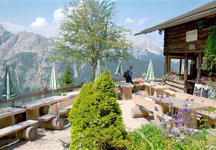
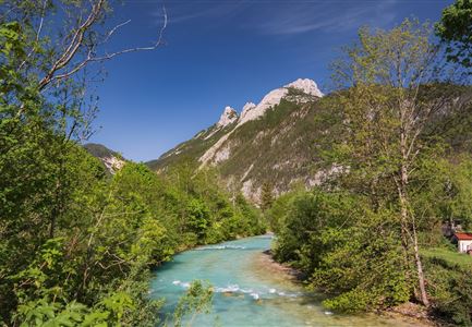
The panoramic and only slightly ascending forest path starts at the Salzbach car park and runs along the river Leutascher Ache, passing the huts Gaistal- & Tillfussalm to the lake Seebensee. The last kilometer is steep and partly on coarse gravel. Therefore we recommoned to park the bike at the Seebenalm.

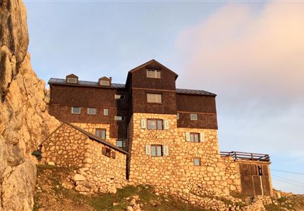
Then it goes steeper uphill to the Seebensee. This crystal clear lake with its Caribbean colours invites you to cool off. After the refreshment it leads further 40 walking minutes very steeply up to the Coburgerhütte. From there you have a breathtaking view of the Seebensee and the Zugspitze. Next to the Coburgerhütte, another natural jewel awaits you, the lake Drachensee.

Details for one direction:

Read More...

Similar Tour Suggestions

Durch die Gleirschklamm - Scharnitz (1).jpg

Hiking

Circular hike through the Gleirsch Gorge and over the Zäunlkopf

Length

17,90 km

Duration

06:45 h

Uphill

907 hm

Altitude

1744 hm

Difficulty

Medium

Herbst am Möserer See - Frau am Ufer (Edit 2).jpg

Hiking

Circular walking path lake Möserer See & Kalvarienberg

Length

3,00 km

Duration

01:00 h

Uphill

78 hm

Downhill

82 hm

Altitude

1291 hm

Difficulty

Easy

Blick ueber Wildmoos nach Seefeld.jpg

Hiking

Circular tour around the Brunschkopf

Length

13,10 km

Duration

04:00 h

Uphill

275 hm

Downhill

272 hm

Altitude

1369 hm

Difficulty

Easy

Muggenmoosalm

Hiking

Circular hike from Seefeld to the Lottenseehütte alpine hut & Muggenmoosalm alpine hut

Length

15,30 km

Duration

04:30 h

Uphill

554 hm

Altitude

1398 hm

Difficulty

Easy

Kurblhang - Leutasch (2).jpg

Hiking

Circular hiking trail viewpoint Kurblhang

Length

3,50 km

Duration

01:30 h

Uphill

181 hm

Altitude

1277 hm

Difficulty

Medium

Wanderweg Hochleithenkopf - Ausblick ins Inntal.jpg

Hiking

Hike to the Hochleithenkopf

Length

8,20 km

Duration

02:30 h

Uphill

200 hm

Altitude

1187 hm

Difficulty

Easy

Wettersteinhuette (l) und Wangalm (r) im Wettersteingebirge (2).jpg

Hiking

Circular hike Wettersteinhütte alpine hut - Wangalm alpine hut - Hämmermoosalm alpine hut

Length

10,20 km

Duration

04:15 h

Uphill

562 hm

Altitude

1756 hm

Difficulty

Medium

Personen bei der Rotmoosalm im Sommer - auf der Terrasse (1).jpg

Hiking

Hike to the Rotmoosalm alpine hut

Length

9,00 km

Duration

05:30 h

Uphill

842 hm

Altitude

2037 hm

Difficulty

Medium