We use cookies for your personalized browsing experience, to personalize content and ads, to provide social media features, and to analyze traffic to our website. We also share information about your use of our website with our social media, advertising and analytics partners. Our partners may combine this information with other data that you have provided to them or that they have collected as part of your use of the Services. (incl. US providers)

Start Point

Leutasch parking Salzbach (P5)

End Point

Leutasch parking Salzbach (P5)

Difficulty

Hard

Total Distance

19,00 km

Descent Meters

1009 m

Highest Point

2234 m

Total Time

04:30 h

Map & Elevation Profile

Start Point

Leutasch parking Salzbach (P5)

End Point

Leutasch parking Salzbach (P5)

Difficulty

Hard

Total Distance

19,00 km

Descent Meters

1009 m

Highest Point

2234 m

Total Time

04:30 h

Hiking

Best Time

Jan

Feb

Mar

Apr

May

Jun

Jul

Aug

Sep

Oct

Nov

Dec

Hiking tour

Bike & Hike

+1

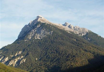
Route: Leutasch / Salzbach parking lot (P5) - old Rotmoosalm - Predigtstuhl - old Rotmoosalm - Leutasch / Salzbach parking lot (P5)

Directions:

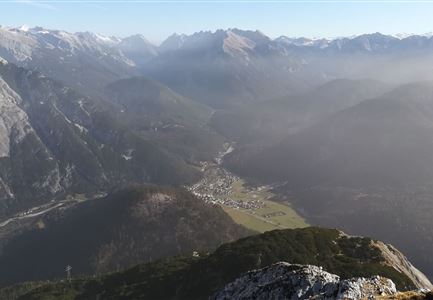
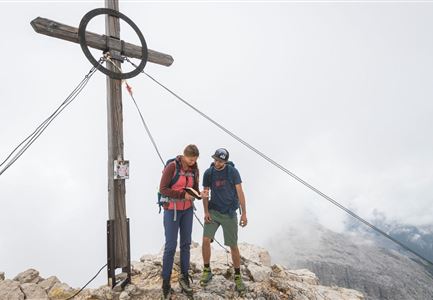
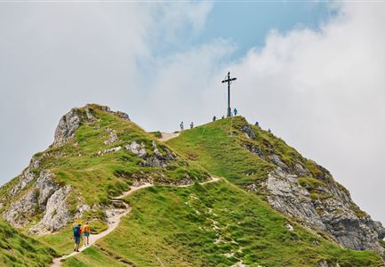
The path leads with only a slight ascent across open alpine meadows and later through lightly forested area to the Leitenbach. Follow the bikeroute Rotmoosalm. Park your bike at the Predigtstuhl turnoff (old Rotmoosalm). Across lush green grassy slopes you come to an overgrown saddle, from where you reach the Predigtstuhl between rugged rocks. At the top, a magnificent view rewards you. Take the same route back to the starting point.

Details for one direction:

  • Bike route nr. 553: approx. 8.5 km, 670 hm uphill, 01:45 h, difficulty: difficult

  • Hike route: approx. 1 km, 340 hm uphill, 01:15 h, difficulty: difficult


If the tour is hiked only, it will takes about 04:45 h.

Alpine emergency call:

Call: 140

Features & Characteristics

Start Point

Leutasch parking Salzbach (P5)

End Point

Leutasch parking Salzbach (P5)

Similar Tour Suggestions

Drohnenaufnahme Hämmermoosalm bei Sonnenuntergangsstimmung.jpg

Hiking

Hike to the Hämmermoosalm

Length

4,00 km

Duration

01:30 h

Uphill

170 hm

Altitude

1417 hm

Difficulty

Easy

Kurze Pause an der Leutascher Ache - mit den Mountainbikes im Gaistal

Hiking

Bike & Hike Gehrenspitze Summit, 2,367 m

Length

21,00 km

Duration

07:00 h

Uphill

1179 hm

Altitude

2367 hm

Difficulty

Hard

Grosse Arnspitze Blick ins Karwendel - Scharnitz

Hiking

Hike Hoher Sattel - Große Arnspitze Summit, 2,196 m

Length

10,30 km

Duration

08:00 h

Uphill

1313 hm

Altitude

2196 hm

Difficulty

Hard

Durch die Gleirschklamm bei Scharnitz.jpg

Hiking

Circular hiking trail Gleirschklamm Gorge

Length

13,10 km

Duration

04:00 h

Uphill

416 hm

Downhill

410 hm

Altitude

1152 hm

Difficulty

Medium

Brunschkopf während der Goldenen Stunde.jpg

Hiking

Viewpoint Brunschkopf via forest road from Mösern

Length

9,10 km

Duration

03:00 h

Uphill

279 hm

Downhill

272 hm

Altitude

1496 hm

Difficulty

Medium

Wanderer auf dem Weg vom Seefelder Joch zur Seefelder Spitze - Gipfelkreuz der Spitze im Blick.jpg

Hiking

"Königstour" The royal's hiking tour

Length

4,40 km

Duration

03:00 h

Uphill

502 hm

Downhill

464 hm

Altitude

2364 hm

Difficulty

Hard

Muggenmoos-Muggenmoosalm (c) Anna Rieder

Hiking

Hike to the Muggenmoosalm alpine hut

Length

3,60 km

Duration

01:15 h

Uphill

80 hm

Altitude

1252 hm

Difficulty

Easy

Seekirchl im Sommer - Seefeld

Hiking

Circular walk in the Möserer valley

Length

3,10 km

Duration

00:45 h

Uphill

12 hm

Altitude

1196 hm

Difficulty

Easy