We use cookies for your personalized browsing experience, to personalize content and ads, to provide social media features, and to analyze traffic to our website. We also share information about your use of our website with our social media, advertising and analytics partners. Our partners may combine this information with other data that you have provided to them or that they have collected as part of your use of the Services. (incl. US providers)

Start Point

Scharnitz parking Länd (P2)

End Point

Scharnitz parking Länd (P2)

Difficulty

Hard

Total Distance

41,00 km

Descent Meters

1800 m

Ascent Meters

1800 m

Highest Point

2749 m

Total Time

09:00 h

Map & Elevation Profile

Start Point

Scharnitz parking Länd (P2)

End Point

Scharnitz parking Länd (P2)

Difficulty

Hard

Total Distance

41,00 km

Descent Meters

1800 m

Ascent Meters

1800 m

Highest Point

2749 m

Total Time

09:00 h

Hiking

Best Time

Jan

Feb

Mar

Apr

May

Jun

Jul

Aug

Sep

Oct

Nov

Dec

Bike & Hike

Hiking

+1

Route: Scharnitz Nature Park Info Center - Bike Trail Tirol - Karwendel Valley - Karwendelhaus - Schlauchkarsattel - Birkkarhütte - Birkkarspitze - Birkkarhütte - Schlauchkarsatte - Karwendel Valley - Bike Trail Tirol - Scharnitz Nature Park Info Center

Directions:

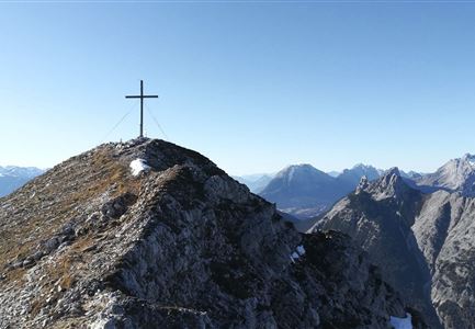
Climbing the highest peak in the Karwendel Mountains is a challenge that is best accomplished as a scenic bike & hike tour. Surefootedness, head for heights and experience in high alpine terrain as well as short climbing passages are absolutely necessary!

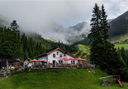
The tour starts directly at the Karwendel parking lot (P2 Länd) at the Scharnitz Nature Park Information Center. Here you saddle up your (e-)bike, cycle eastwards on the Hinterautalstraße, orient yourself to the left after the Isar bridge on the impressive Bike Trail Tirol and follow the yellow signs through the picturesque Karwendel valley to the historic Karwendelhaus at 1,765 meters above sea level.

Since 1908, the refuge has offered a popular base station for Karwendel crossings, summit tours and climbing excursions. During the warm summer months, you can also spend the night at the historic hut - but you are definitely asked to make a reservation in good time. If you reach the Karwendelhaus and bring a suitable

Read More...

Features & Characteristics

Refreshment stops

Start Point

Scharnitz parking Länd (P2)

End Point

Scharnitz parking Länd (P2)

Similar Tour Suggestions

Ausblick von der Arnplattenspitze auf die Gehrenspitze, Hohe Munde

Hiking

Circular hike Arnplattenspitze, 2,171 m

Length

8,60 km

Duration

07:00 h

Uphill

1106 hm

Altitude

2171 hm

Difficulty

Hard

Partially open
Wanderung zur Eppzirler Alm im Sommer - Mann und Frau von hinten mit Eppzirler Alm.jpg

Hiking

Circular hike via Eppzirler Alm and Nördlinger hut to Seefeld

Length

20,40 km

Duration

10:00 h

Uphill

1464 hm

Altitude

2231 hm

Difficulty

Hard

Brunnsteinspitze mit Gipfelkreuz - Scharnitz (4).jpg

Hiking

Hike to the Brunnsteinspitze Summit, 2,180 m

Length

12,70 km

Duration

08:30 h

Uphill

1454 hm

Altitude

2180 hm

Difficulty

Hard

Wandern am Brunschkopf

Hiking

Brunschkopf viewing platform via Wildmoosalm from Leutasch

Length

12,80 km

Duration

04:30 h

Uphill

441 hm

Downhill

438 hm

Altitude

1493 hm

Difficulty

Medium

Katzenkopfhuette mit Blumenwiese im Sommer

Hiking

Hike to the Katzenkopfhütte alpine hut

Length

5,20 km

Duration

02:00 h

Uphill

243 hm

Altitude

1360 hm

Difficulty

Easy

Gleirschklamm - Scharnitz (17).jpg

Hiking

Hike through the Gleirschklamm to the Möslalm

Length

21,20 km

Duration

06:30 h

Uphill

505 hm

Downhill

498 hm

Altitude

1261 hm

Difficulty

Medium

Weg vom Halleranger nach Scharnitz - Karwendel Hoehenweg Etappe 6

Hiking

Karwendel Hight Trail (Trail 6): Hallerangerhaus - Scharnitz

Length

19,30 km

Duration

05:30 h

Uphill

30 hm

Downhill

835 hm

Altitude

1768 hm

Difficulty

Medium

Sonnenaufgang im Karwendel_Speckkarspitze

Hiking

Bike & Hike Speckkarsptitze, 2,621 m

Length

44,00 km

Duration

11:00 h

Uphill

1794 hm

Altitude

2621 hm

Difficulty

Hard