Tourismusverband Seefeld
We use cookies for your personalized browsing experience, to personalize content and ads, to provide social media features, and to analyze traffic to our website. We also share information about your use of our website with our social media, advertising and analytics partners. Our partners may combine this information with other data that you have provided to them or that they have collected as part of your use of the Services. (incl. US providers)

Start Point

Weidach Leutasch

End Point

Weidach Leutasch

Difficulty

Hard

Total Distance

50,00 km

Descent Meters

512 m

Highest Point

1226 m

Map & Elevation Profile

Start Point

Weidach Leutasch

End Point

Weidach Leutasch

Difficulty

Hard

Total Distance

50,00 km

Descent Meters

512 m

Highest Point

1226 m

Cross-country Skiing

Best Time

Jan

Feb

Mar

Apr

May

Jun

Jul

Aug

Sep

Oct

Nov

Dec

Klassisch

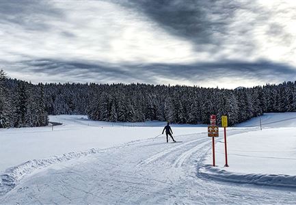
The 50 km classic route offers everything that the experienced classic racer could wish for. Sharp climbs and descents, interesting routes through the woods and and all surrounded by the beautiful panorama of the Wetterstein and Karwendel mountains. The heart of the course is the unique Plaikloipe (C9) which, after the challenging climb, offers lovely descents and wonderful views. The stretch on the Panorama track (B7) and Wald trail (B11) before the finish line is also a sleeper hit for those who love classic tracks.

The challenging classic route is taken twice (50 km in total) and it is considered as the leading discipline of the largest cross-country skiing classic in Austria. The course can of course also be run only once (25km).

More information about the program and details on registration can be found here.

Features & Characteristics

Start Point

Weidach Leutasch

End Point

Weidach Leutasch

Klassisch

Yes

Similar Tour Suggestions

Trailrunning in der Region Seefeld - Läuferinnen auf Trail im Wald - Gaistal.jpg

Running

Steckenweg Trailrun-Route

Length

13,00 km

Duration

04:30 h

Uphill

480 hm

Altitude

1550 hm

Difficulty

Easy

Nordic Summer Camp 2021 - Laeufer bei Laufrunde um den Moeserer See.jpg

Running

Trail Run Loop Möserer See

Length

9,20 km

Duration

02:00 h

Uphill

320 hm

Altitude

1500 hm

Difficulty

Easy

Weitwandern Etappe 2 Teilnehmer am Weg bei Huette

Hiking

Stage 2: From Leutasch to Mösern – Tyrol’s 1. Winter Multi-day Hike

Length

16,00 km

Duration

05:00 h

Uphill

402 hm

Downhill

324 hm

Altitude

1393 hm

Difficulty

Medium

Open
Radfahrerinnen bei herbstlichem Wetter auf dem Weg zur Gaistalalm (1).jpg

Cycling

Biketour Gaistalalm alpine hut

Length

4,00 km

Duration

00:30 h

Uphill

136 hm

Downhill

30 hm

Altitude

1356 hm

Difficulty

Easy

Leutasch - Winterwanderweg 15 Katzenloch-3.jpg

Hiking

Stage 2: From Seefeld to Scharnitz - Seefeld High Plateau Winter Multi-day Hike

Length

12,37 km

Duration

03:30 h

Uphill

59 hm

Downhill

278 hm

Altitude

1182 hm

Difficulty

Easy

Open
Reitherjoch-Alm (c) Anna Rieder

Cycling

Biketour No. 5032 Reitherjoch Alm

Length

12,60 km

Duration

02:00 h

Uphill

372 hm

Downhill

368 hm

Altitude

1495 hm

Difficulty

Medium

Gschwandtkopf Speichersee - Trailrunner in der Distanz läuft entlang des Sees bei Sonnenaufgangsstimmung.jpg

Running

Gschwandtkopf Trailrun Route

Length

9,80 km

Duration

03:30 h

Uphill

430 hm

Altitude

1486 hm

Difficulty

Easy

Bienenlehrpfad Reith - kleine Stadl am Anfang des Pfades bei Reith (1).jpg

Running

Auland Running Route

Length

7,20 km

Duration

01:50 h

Uphill

162 hm

Downhill

156 hm

Altitude

1203 hm

Difficulty

Medium