Start Point

Parking Lot P6 Hoher Sattel

End Point

Parking Lot P6 Hoher Sattel

Difficulty

Hard

Total Distance

8,60 km

Descent Meters

1106 m

Ascent Meters

1106 m

Highest Point

2171 m

Total Time

07:00 h

Map & Elevation Profile

Start Point

Parking Lot P6 Hoher Sattel

End Point

Parking Lot P6 Hoher Sattel

Difficulty

Hard

Total Distance

8,60 km

Descent Meters

1106 m

Ascent Meters

1106 m

Highest Point

2171 m

Total Time

07:00 h

Hiking

Best Time

Jan

Feb

Mar

Apr

May

Jun

Jul

Aug

Sep

Oct

Nov

Dec

Hiking tour

Circular hike

+2

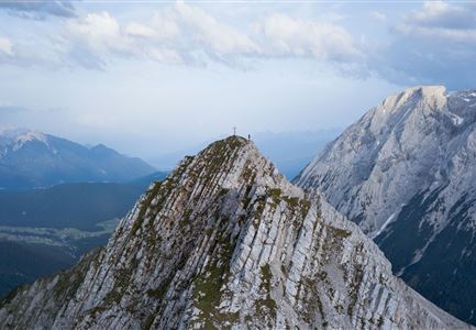
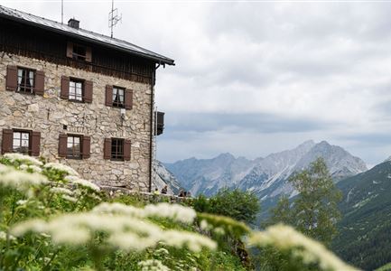
Starting from the pay parking lot (P6), follow the path along the Leutascher Ache in an eastern direction for 100 meters. Shortly after the pedestrian bridge, turn right onto a steep path that leads in serpentines through light forest. After the first ascent, a wonderful view opens up over Leutasch and the Puittal valley. The imposing summit of the Arnplattenspitze in front of your eyes, you hike about 900 meters through large pine fields in the direction of Weißlehnkopf (2,002 m) until you reach the signposted turnoff Hoher Sattel on the right. Here follow the difficult (black) path straight ahead towards the summit. Surefootedness and a head for heights are absolutely necessary, as the last part up to the Arnplattenspitze is secured with a steel rope.

At the summit cross you can enjoy a breathtaking 360 degree panorama over the entire high plateau of the Seefeld region. After a well-deserved rest, hike back to the junction and take the path on the left towards Hoher Sattel. This is a steep and in sections gravelly path that leads to the wide forest road no. 801. Follow this path through the Satteltal back to the starting point Leutasch/Ahrn.

Note: An early

Read More...

Features & Characteristics

Stamina

Technique

Start Point

Parking Lot P6 Hoher Sattel

End Point

Parking Lot P6 Hoher Sattel

Loop tour

Yes

Similar Tour Suggestions

Reitherjoch Alm in Seefeld

Hiking

Circular hike to the Reitherjochalm alpine hut

Length

6,60 km

Duration

02:30 h

Uphill

321 hm

Altitude

1479 hm

Difficulty

Easy

Leutascher Geisterklamm - Wasserfallsteig (2).jpg

Hiking

​Hike through the Leutasch Spirit Gorge and to the Waterfall Trail

Length

5,00 km

Duration

02:30 h

Uphill

225 hm

Downhill

221 hm

Altitude

1061 hm

Difficulty

Medium

Closed
Brunschkopf_inkl_Logo.jpg

Hiking

Brunschkopf viewing platform via Geiernest from Seefeld, return via Wildmoosalm

Length

9,20 km

Duration

03:15 h

Uphill

316 hm

Downhill

313 hm

Altitude

1493 hm

Difficulty

Medium

Muggenmoosalm bei Leutasch im Sommer - Drohnenaufnahme.jpg

Hiking

Hike to the Muggenmoosalm alpine hut

Length

3,60 km

Duration

01:15 h

Uphill

80 hm

Altitude

1252 hm

Difficulty

Easy

Blumenwiese in Neuleutasch

Hiking

Hike from Leutasch to Seefeld

Length

4,60 km

Duration

01:30 h

Uphill

118 hm

Downhill

83 hm

Altitude

1225 hm

Difficulty

Easy

Gipfel Grosse Arnspitze - Scharnitz

Hiking

Hike to the Große Arnspitze Summit, 2,196 m

Length

9,00 km

Duration

07:30 h

Uphill

1247 hm

Altitude

2196 hm

Difficulty

Hard

Sonnenaufgang Aussichtsplattform Bruschkopf - Paar steht am Geländer der Plattform - Aufnahme von hinten - Paar schaut sich an.jpg

Hiking

Viewpoint Brunschkopf via Möserer Höhe

Length

8,70 km

Duration

03:00 h

Uphill

311 hm

Downhill

314 hm

Altitude

1499 hm

Difficulty

Medium

Familien-Weitwanderung im Gaistal - Familie vor Hohe Munde - Alle lächeln.jpg

Hiking

Complete Route for the Leutasch 3-Day Hut Hike for Families

Length

16,20 km

Duration

10:00 h

Uphill

960 hm

Altitude

2132 hm

Difficulty

Medium