Start Point

Seefeld Railway Station

End Point

Seefeld Railway Station

Difficulty

Medium

Total Distance

11,60 km

Descent Meters

297 m

Ascent Meters

297 m

Highest Point

1485 m

Total Time

03:30 h

Map & Elevation Profile

Start Point

Seefeld Railway Station

End Point

Seefeld Railway Station

Difficulty

Medium

Total Distance

11,60 km

Descent Meters

297 m

Ascent Meters

297 m

Highest Point

1485 m

Total Time

03:30 h

Hiking

Best Time

Jan

Feb

Mar

Apr

May

Jun

Jul

Aug

Sep

Oct

Nov

Dec

Hiking tour

Circular hike

+3

The hike starts at Seefeld train station and first leads through the pedestrian zone. From there, the route continues through the Kirchwald district towards Mösern. Trail No. 2 gently ascends through nature, offering beautiful views along the way. After some time, the high point near Mösern is reached.

At the small chapel, the path crosses the road. Just on the left, a signpost points towards Gschwandtkopf. The route first follows Trail No. 4, which leads to a junction after about ten minutes. From here, Trail No. 85 continues uphill to the summit of Gschwandtkopf. At the top, the Sonnenalm invites visitors to take a break. Before descending, it is worth taking a short walk around the reservoir, which blends beautifully into the landscape and reflects the surrounding peaks in its calm waters.

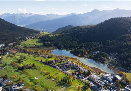
After the stop, the trail descends towards Wildsee. The picturesque lake accompanies the final section of the hike before arriving back at the starting point in Seefeld. A varied route that combines nature, movement, and stunning views.

Features & Characteristics

Stamina

Technique

Start Point

Seefeld Railway Station

End Point

Seefeld Railway Station

Family-friendly

Yes

Loop tour

Yes

Similar Tour Suggestions

Wildsee im Herbst - Drohnenaufnahme - Blick auf Golfplatz und See mit Bergpanorama.jpg

Hiking

Circular hike from Seefeld to Auland & Reith

Length

9,30 km

Duration

02:45 h

Uphill

139 hm

Downhill

141 hm

Altitude

1199 hm

Difficulty

Easy

Sonnenaufgang am Brunschkopf

Hiking

Circular hike to the Brunschkopf viewing platform starting in Mösern

Length

12,70 km

Duration

04:00 h

Uphill

382 hm

Altitude

1498 hm

Difficulty

Medium

Spaziergang mit Hund in Unterleutasch - Mann läuft mit Hund entlang von Bäumen Aufnahme Richtung Sonne.jpg

Hiking

Tour of lawn "toler"

Length

4,20 km

Duration

00:45 h

Uphill

13 hm

Altitude

1072 hm

Difficulty

Easy

Kristenalm

Hiking

Bike & Hike Kristenalm

Length

25,00 km

Duration

04:00 h

Uphill

420 hm

Altitude

1249 hm

Difficulty

Medium

Wanderer auf dem Predigtstuhl.jpg

Hiking

Bike & Hike Predigtstuhl Summit, 2,234 m

Length

19,00 km

Duration

04:30 h

Uphill

1015 hm

Altitude

2234 hm

Difficulty

Hard

Durchs Karwendeltal aufs Karwendelhaus - Scharnitz

Hiking

Hike to the Karwendelhaus

Length

36,00 km

Duration

11:15 h

Uphill

839 hm

Altitude

1765 hm

Difficulty

Hard

Brunschkopf während der Goldenen Stunde.jpg

Hiking

Viewpoint Brunschkopf via forest road from Mösern

Length

9,10 km

Duration

03:00 h

Uphill

279 hm

Downhill

272 hm

Altitude

1496 hm

Difficulty

Medium

Ropferstubm im Herbst - Moesern-Buchen

Hiking

Hike to the Inn Ropferstub'm

Length

9,20 km

Duration

03:00 h

Uphill

246 hm

Altitude

1316 hm

Difficulty

Easy