Tourismusverband Seefeld
We use cookies for your personalized browsing experience, to personalize content and ads, to provide social media features, and to analyze traffic to our website. We also share information about your use of our website with our social media, advertising and analytics partners. Our partners may combine this information with other data that you have provided to them or that they have collected as part of your use of the Services. (incl. US providers)

Start Point

Scharnitz information centre (parking Länd P2)

End Point

Möslalm Scharnitz

Difficulty

Medium

Total Distance

22,60 km

Descent Meters

392 m

Ascent Meters

392 m

Highest Point

1272 m

Total Time

02:30 h

Map & Elevation Profile

Start Point

Scharnitz information centre (parking Länd P2)

End Point

Möslalm Scharnitz

Difficulty

Medium

Total Distance

22,60 km

Descent Meters

392 m

Ascent Meters

392 m

Highest Point

1272 m

Total Time

02:30 h

Cycling

Best Time

Jan

Feb

Mar

Apr

May

Jun

Jul

Aug

Sep

Oct

Nov

Dec

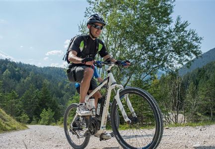
Mountainbike tour

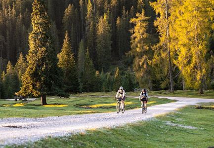
Comfortable tour with a short, steep ascent, on good forest paths through the beautiful valley Gleirschtal.

The route starts at the Scharnitz Information Centre  and follows a low-traffic, asphalted municipal road for the first 1.5 km. Shortly before the Isarlodge Wiesenhof, the well-drivable forest path begins straight ahead over the Gleirschhöhe to the junction Gleirschtal in approx. 4.5 km. After a rapid descent and crossing of the Isar, the ascent follows - the so-called "Krapfen". This is the only part where endurance and stamina are required. After reaching the Gleirschtalanhöhe, passing magnificent alpine pastures, you reach a junction, where you continue in the direction of the Möslalm. At the next junction you can either drive straight ahead or keep right and after a short steep ascent you will reach the Möslalm. Now you have earned a hearty and tasty meal at the rustic Möslalm.

Starting point for various mountain tours, e.g. to the Hohe Gleirsch. Continuation from the Möslalm to the Pfeishütte possible (very steep), see route description 581. Back on the same path.

Features & Characteristics

Start Point

Scharnitz information centre (parking Länd P2)

End Point

Möslalm Scharnitz

Similar Tour Suggestions

Verbindung-Seefeld-Reith Pfarrhügel (c) Anna Rieder

Cycling

Bike-connection No. 5030 Seefeld-Reith

Length

10,20 km

Duration

00:35 h

Uphill

120 hm

Downhill

115 hm

Altitude

1193 hm

Difficulty

Easy

Katzenkopf (c) Anna Rieder

Cycling

Biketour No. 541 Katzenkopf-Fluder

Length

8,50 km

Duration

01:10 h

Uphill

259 hm

Altitude

1370 hm

Difficulty

Hard

Radfahrer unterwegs im Gaistal mit Blick auf die Leutascher Ache

Cycling

Biketour No. 552 Gaistal-Hochfeldern Alm

Length

20,20 km

Duration

02:00 h

Uphill

539 hm

Downhill

536 hm

Altitude

1733 hm

Difficulty

Hard

Gravelbike - Anfahrt zur Gaistalalm

Cycling

Bike Trail Tirol Etappe 06: Ehrwald-Scharnitz

Length

40,00 km

Duration

04:00 h

Uphill

990 hm

Downhill

1020 hm

Altitude

1590 hm

Difficulty

Medium

Radfahrer bei der Auffahrt zur Rotmoosalm - Pause mit Blick auf die Berge

Cycling

Biketour Nr. 553 Gaistal-Rotmoosalm

Length

20,10 km

Duration

02:30 h

Uphill

838 hm

Downhill

834 hm

Altitude

2032 hm

Difficulty

Hard

Wildmoosalm im Sommer - Hütte mit Kuh.jpg

Cycling

Gravelbiketour Wildmoos

Length

20,00 km

Duration

03:15 h

Uphill

450 hm

Altitude

1510 hm

Difficulty

Medium

E-Biken in Mösern mit Blick auf die Hohe Munde

Cycling

Bikeroute No. 5080 Rauthhütte

Length

5,00 km

Duration

01:20 h

Uphill

423 hm

Downhill

416 hm

Altitude

1601 hm

Difficulty

Hard

Wettersteinhütte_Wangalm

Cycling

Biketour No. 540 Wettersteinhütte-Wangalm

Length

14,00 km

Duration

01:30 h

Uphill

618 hm

Altitude

1761 hm

Difficulty

Hard